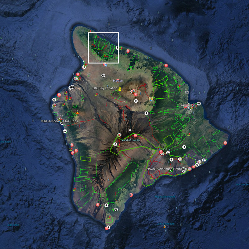
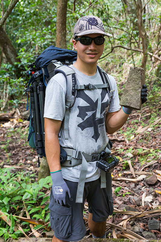
Day 1: Farther than I had been before
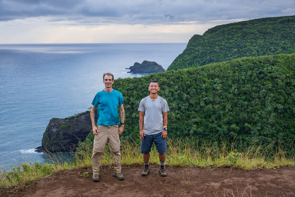
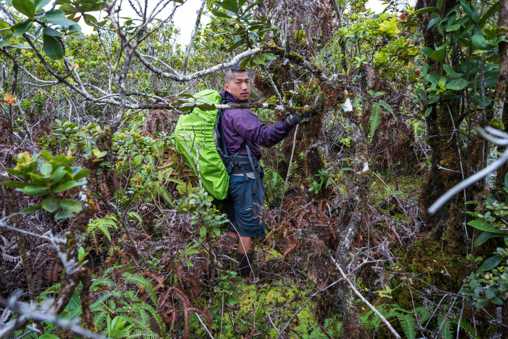
Jacob, a friend of Chris, joined us for the trail section of the hike, but he planned to turn around once we started
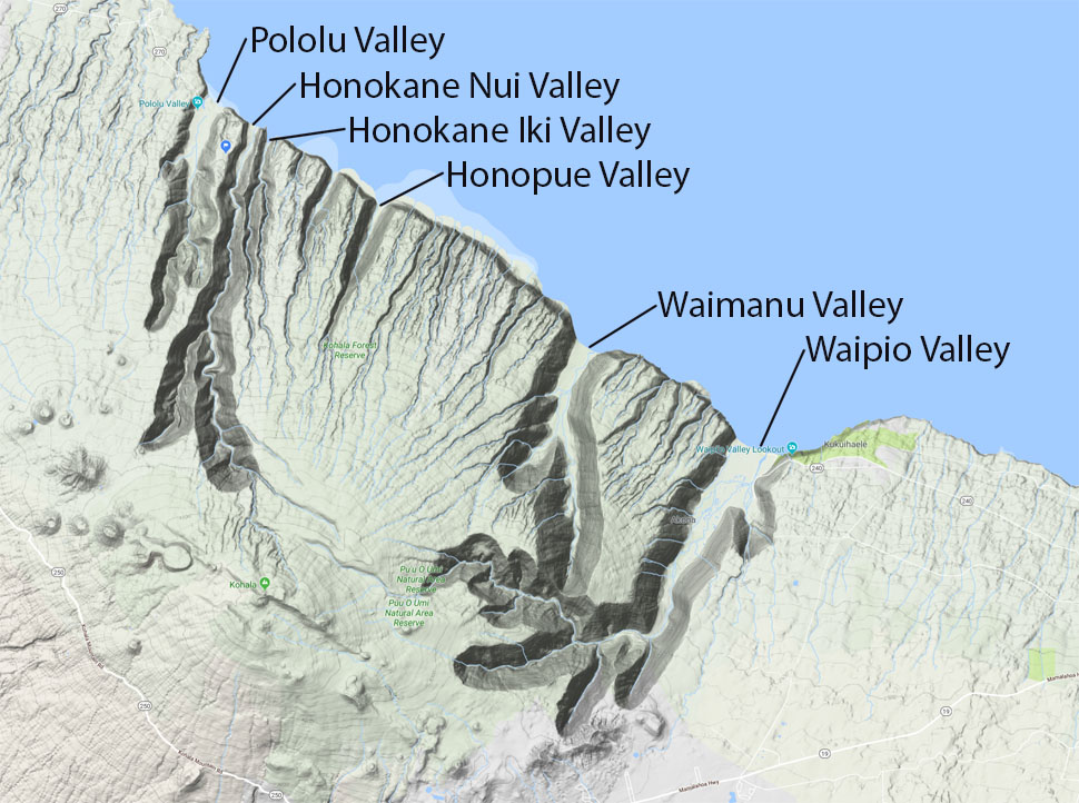
bushwhacking. I had hiked from Pololū to Honokāne Nui to Honokāne Iki many times before, including with my wife on our
honeymoon, so I was familiar with this first section. Chris and Jacob had hiked to the end of the KDT several times previously.
For these reasons, I wasn’t concerned about the KDT section of the expedition.
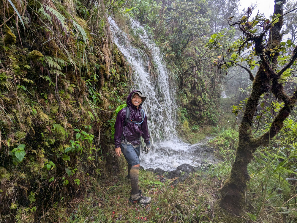
The hike had an inauspicious start as rain began just as we arrived at the Pololū parking lot in the predawn darkness.
Fortunately, the rain stopped by the time we began ascending the ridge on the far side of the valley. The trail descending
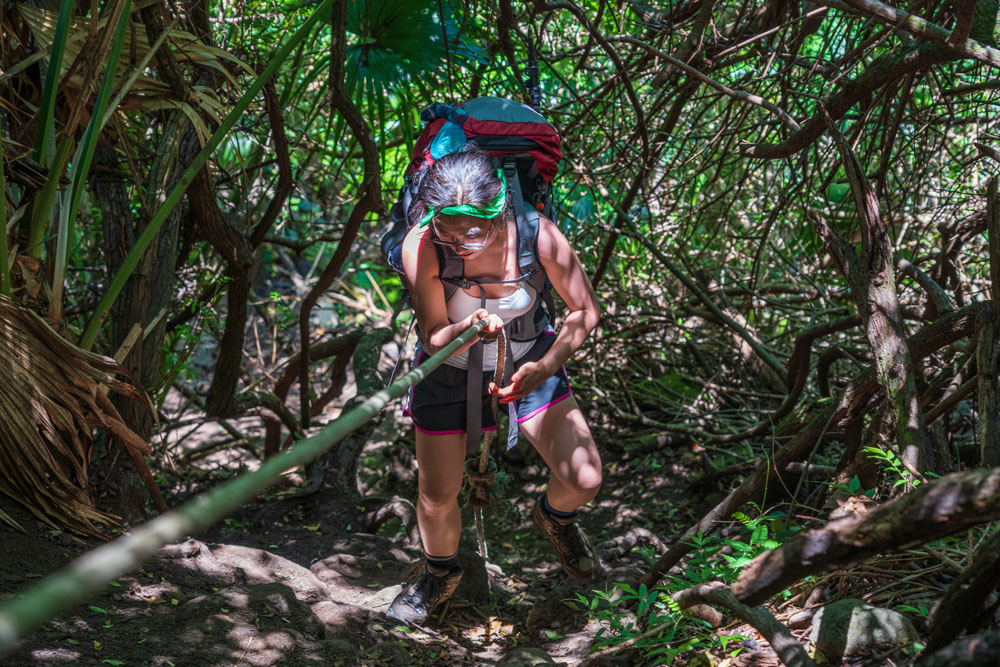
into Honokāne Nui fell off the hillside during the 2006 earthquake, and there was the usual section of ropes tied off to trees
to assist with the descent.
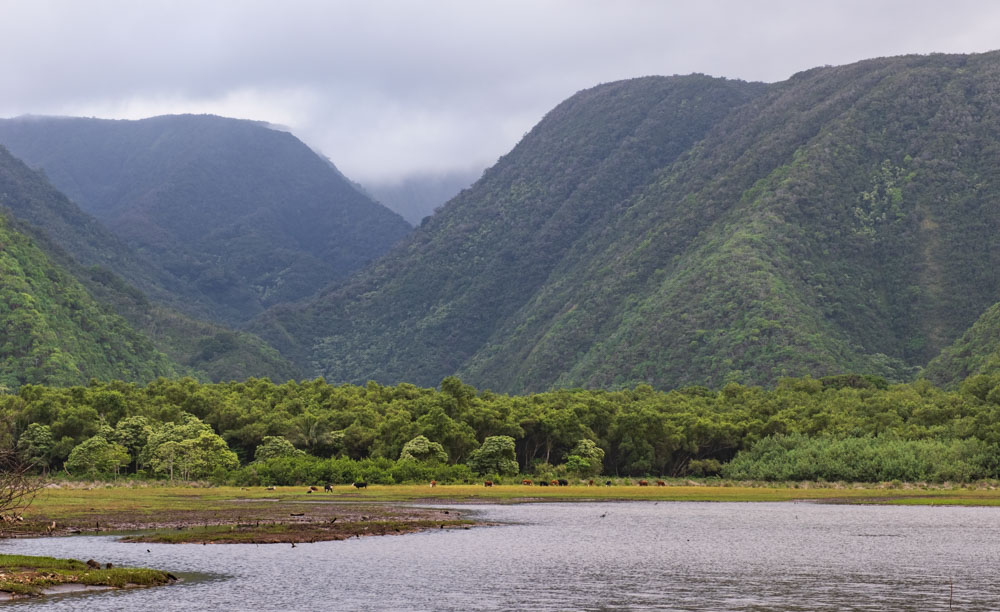
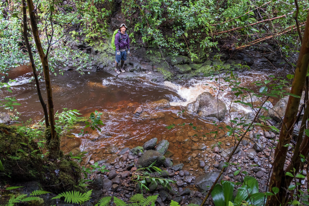
While Jacob took off his boots to cross the Honokāne Nui creek, I managed to jump from rock to rock to cross it. We ascended
the next ridge and then dropped down into Honokāne Iki, where we took a break at the beach. The Hall expedition spent their
first night here, and we arrived after less than three hours of hiking. Bill Sproat, the original caretaker of the Kohala Ditch,
built a cabin for his family here in the early 1900s. My understanding is that it was washed away in the 55-foot 1946 tsunami.
However, the Sproat family rebuilt the cabin and still sometimes uses it. The cabin is thoroughly sealed and usually surrounded
by copious mosquitoes.
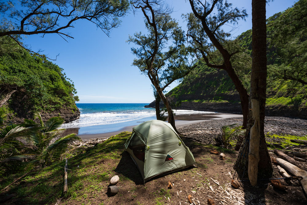
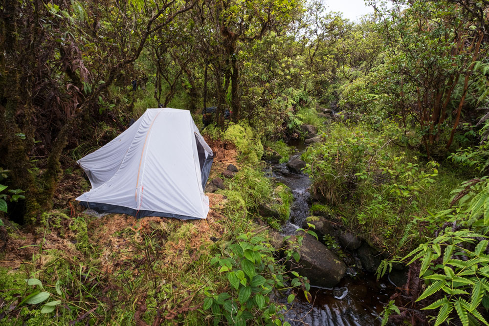
Camping in Honokāne Iki years ago, when it was still allowed.
The Sproat Cabin in Honokāne Iki.
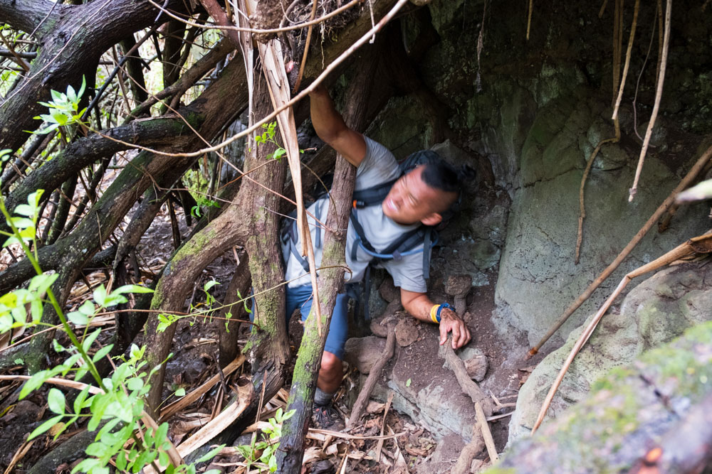
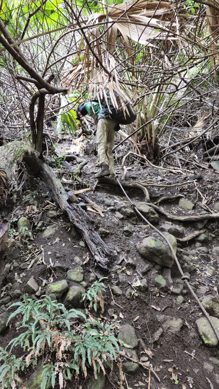
The section of KDT departing Honokāne Iki was horrible and maddening. It was the worst section of the entire KDT—and that’s
saying a lot. It was badly eroded, and innumerable trees and debris had fallen across it. This section of trail was slightly
different every time I hiked it, so it seems the slope was still experiencing a slow-motion landslide. The trail was badly
side-sloped, loose, and one must constantly fight to avoid slipping off it entirely. Massive amounts of crawling and contorting
were required to get through the fallen trees. Taking off one’s backpack, shoving it through a hole in the branches, and then
army-crawling after it was occasionally necessary.
Once the trail reached the ridge, it improved to the point we could consistently walk on it, but it still wasn’t good. It
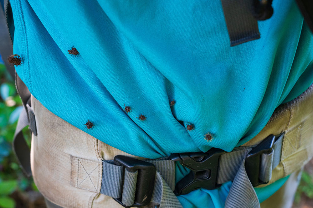
was frequently overgrown, and it was hard to follow in any flat area due to crisscrossing pig trails. There were spiky seed
pods that stuck to our clothes, mud puddles, and innumerable spider webs. I was the tallest member of the group, and though
Chris and Jacob were in front, they often only cleared the webs to their head heights. As a result, I caught the slightly higher
webs with my face, which was always extremely pleasant. There were intermittent rain showers again, and each time I had to
decide whether to get wet from the rain or put on my rain jacket and sweat inside. I usually chose the rain. We did get some
good views back toward where we had started from, though.
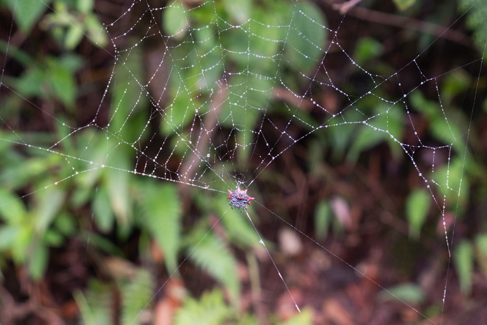
These weird-shaped spiders made the webs that I most commonly cleared using my face.
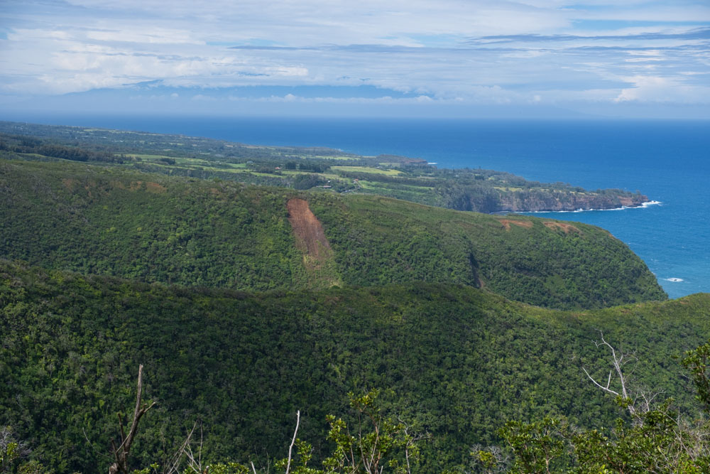
Honokane Iki is in the foreground, then Nui, then Pololu is behind it.
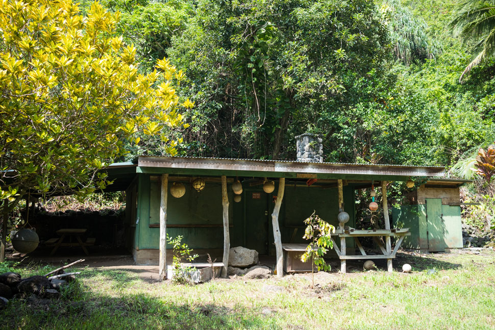
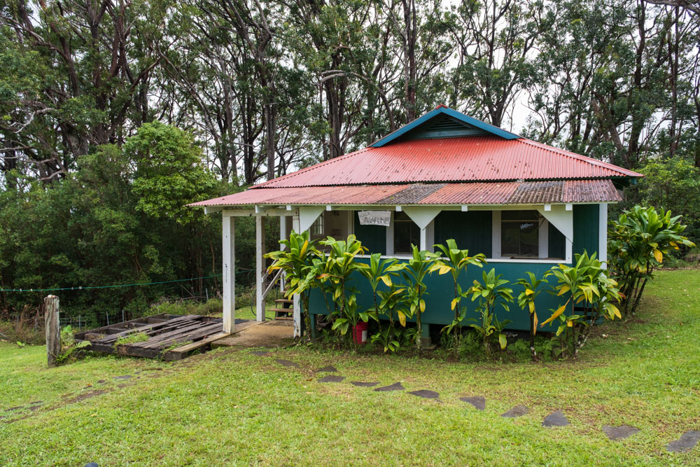
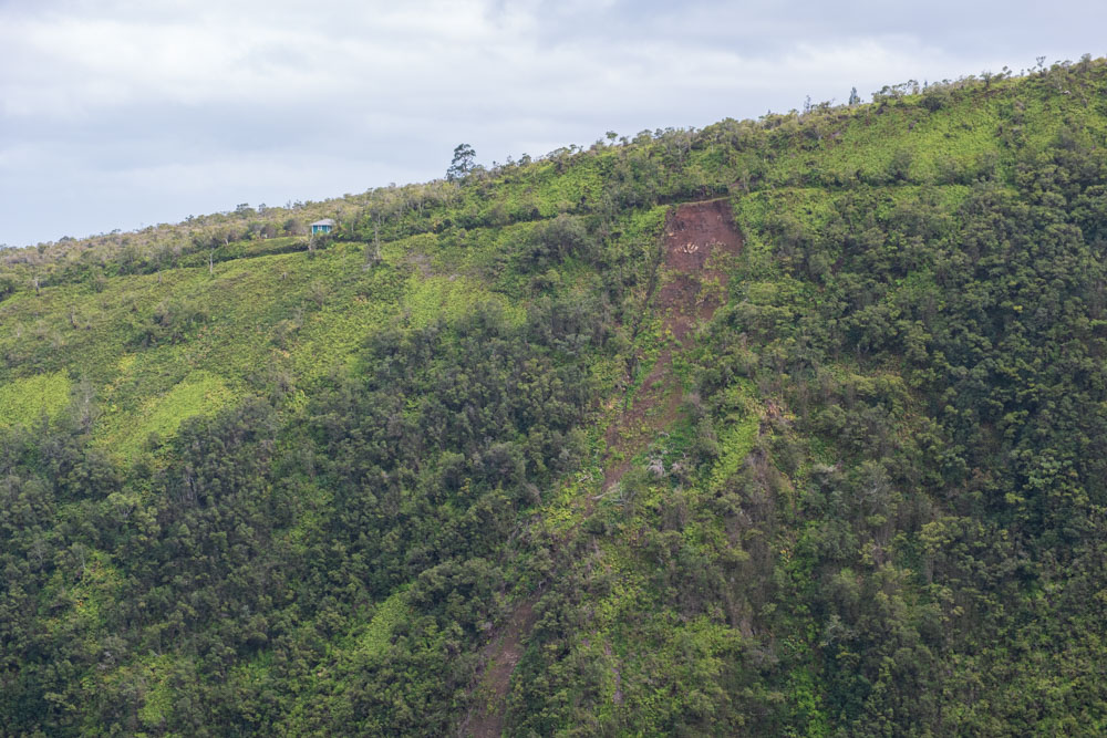
A couple hours after leaving Honokāne Iki, we arrived at a cabin. A sign over the patio informed me it was called Hale Awini.
This one was new to me, since I hadn’t been this far before.
I had tried to hike to this cabin a few years earlier, but I ran out of water due to slow progress on the awful trail and turned
around. Entertainingly, Chris’s first attempt to reach the cabin had failed for the same reason and in a similar spot as mine. I
believe the cabin was originally constructed by the crews maintaining the Kohala Ditch, but it likely has changed ownership and
has been rebuilt in the last century. John Hall wrote in his 1977 expedition account that it was "no longer being maintained
and... dilapidated." However, it was in decent shape now, and I've heard of high-priced helicopter tours bringing clients here for
massages with views of the Hāmākua valleys. At any rate, the cabin was privately owned and locked, and so we passed on without
entering it.
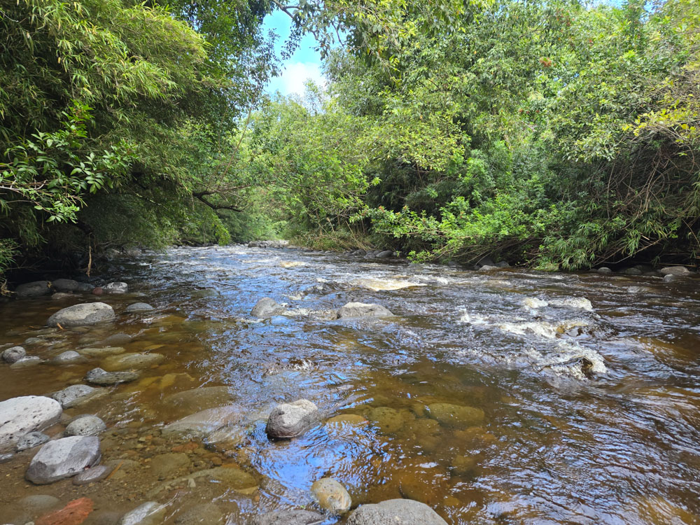
We spent the next few hours hiking in and out of a number of valleys and gulches. The trail quality improved from abysmal to
merely poor (with a few small sections of good!). This section was regularly hiked by humans, and occasionally there was a bit of
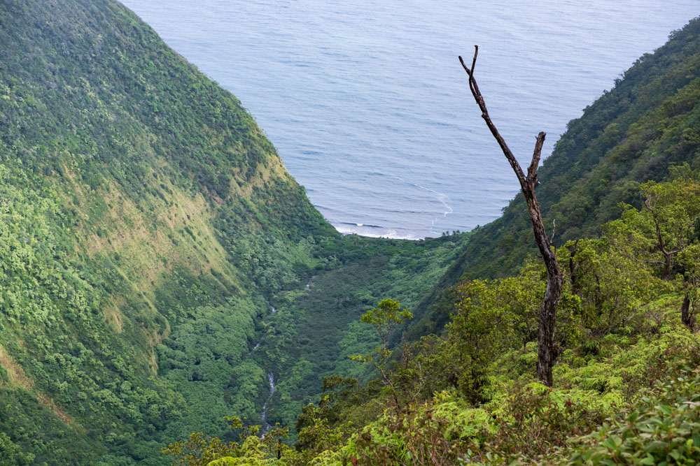
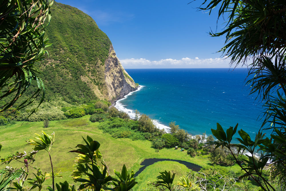
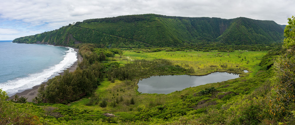
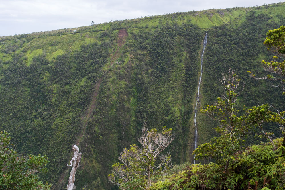
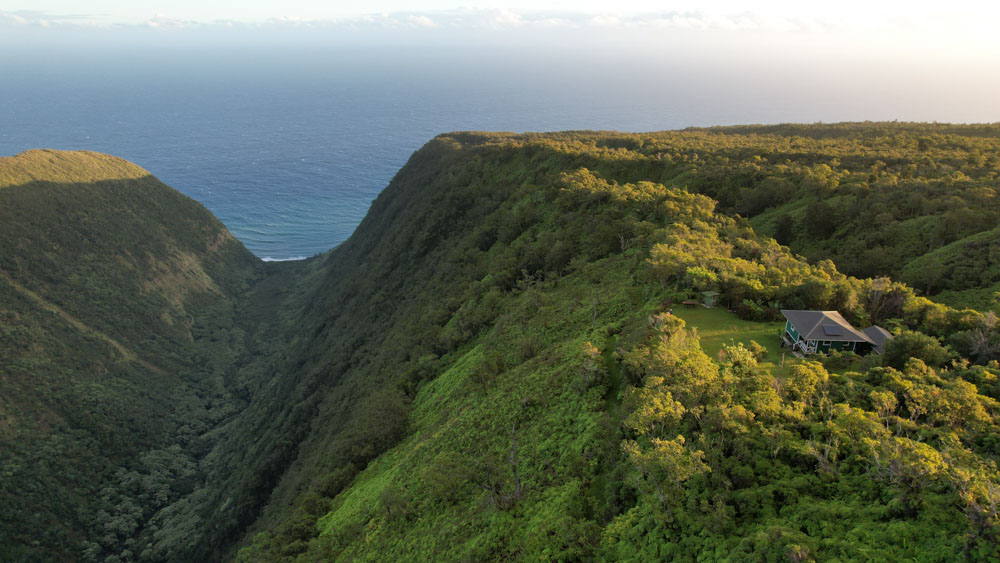
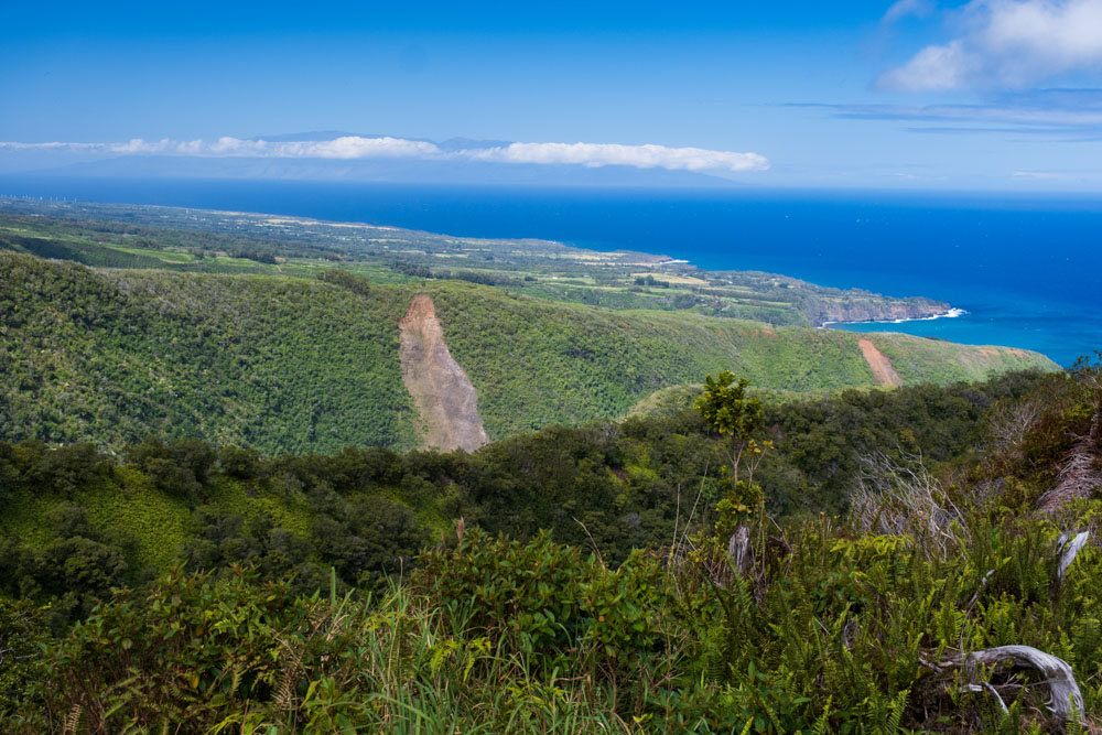
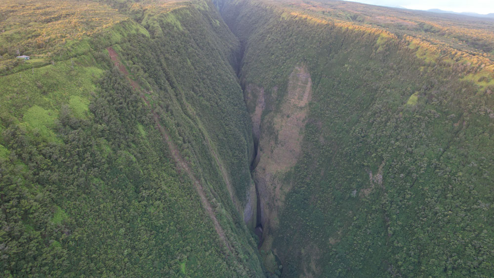
maintenance. Finally, we arrived to the edge of Honopue, the deepest valley on the island. At 2000 feet deep, it was more than
twice as deep as Waipiʻo. A ribbon waterfall meandered down the wall opposite us. The view was breathtaking. I could see a tiny
cabin, dwarfed by the scale of the cliff, perched on the rim across the valley from us.
The trail turned mauka (inland) and ran along the wall toward the back of the valley. This section was of excellent quality
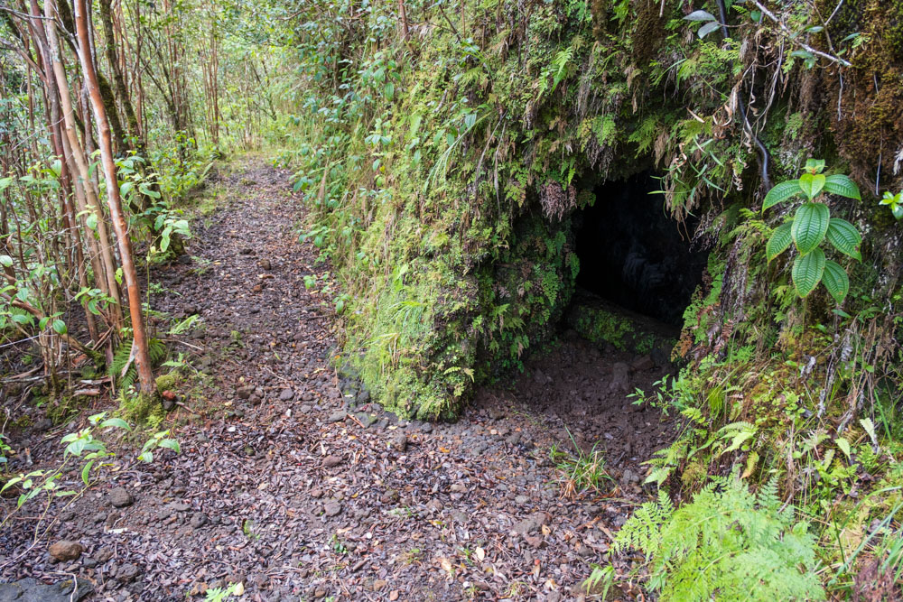
and probably one of the only trail sections that a mule could still follow. The valley narrowed, and I came to a hole in the
mountainside that was the first entrance to the Hāmākua Ditch I had seen on this trip. The ditch water flowed inside tunnels
for many miles west from here, and ultimately it sprayed into Honokāne Nui Valley as a waterfall.
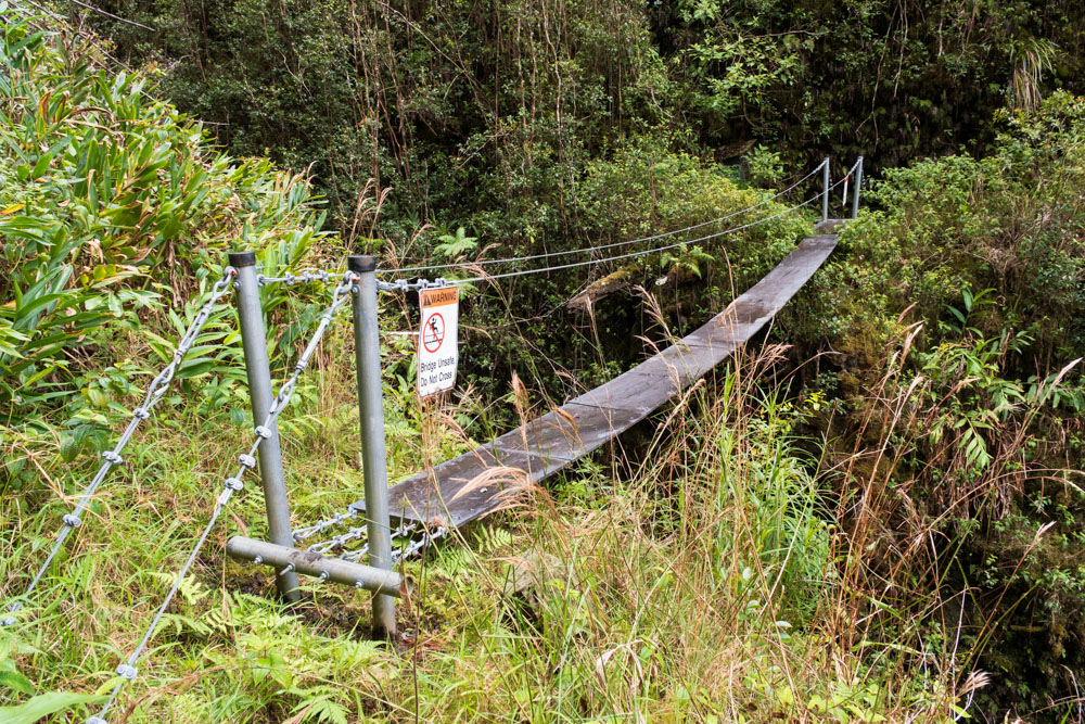
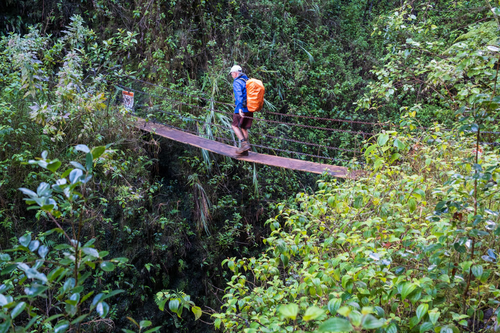
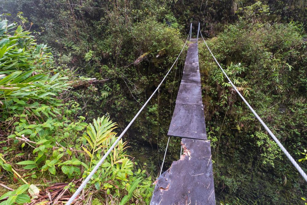
Just beyond the ditch entrance was a bridge of the sort I had only ever seen in movies. It was a cable suspension bridge
about two feet wide. There were two cables that functioned as handrails, but they were only occasionally linked to the pathway
below. Behind the bridge, dangling from the far side of the valley were the remains of another cable bridge of similar
construction. It had clearly collapsed years earlier. There were also a few askew planks protruding from the cliff that
remained from the original, larger, mule-rated bridge. The roar of the Honopue River filled the air, but the valley was so deep
and the walls were so steep that I couldn’t see the water at all. A "Bridge Unsafe, Do Not Cross" sign welcomed me.
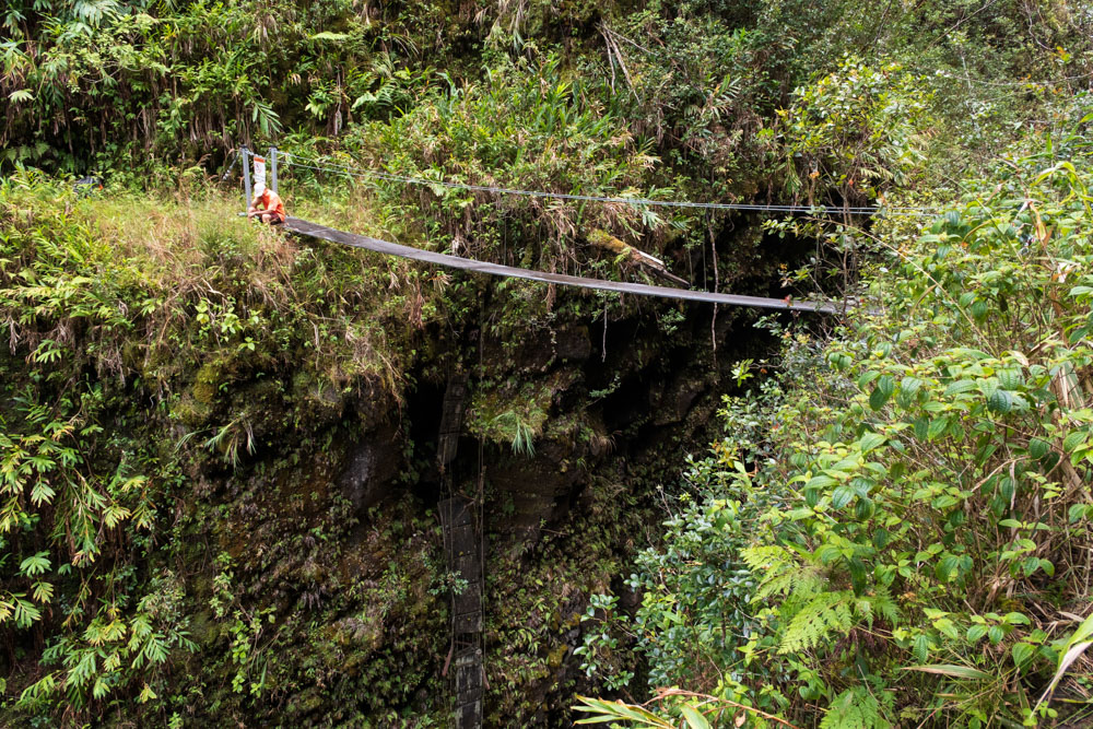
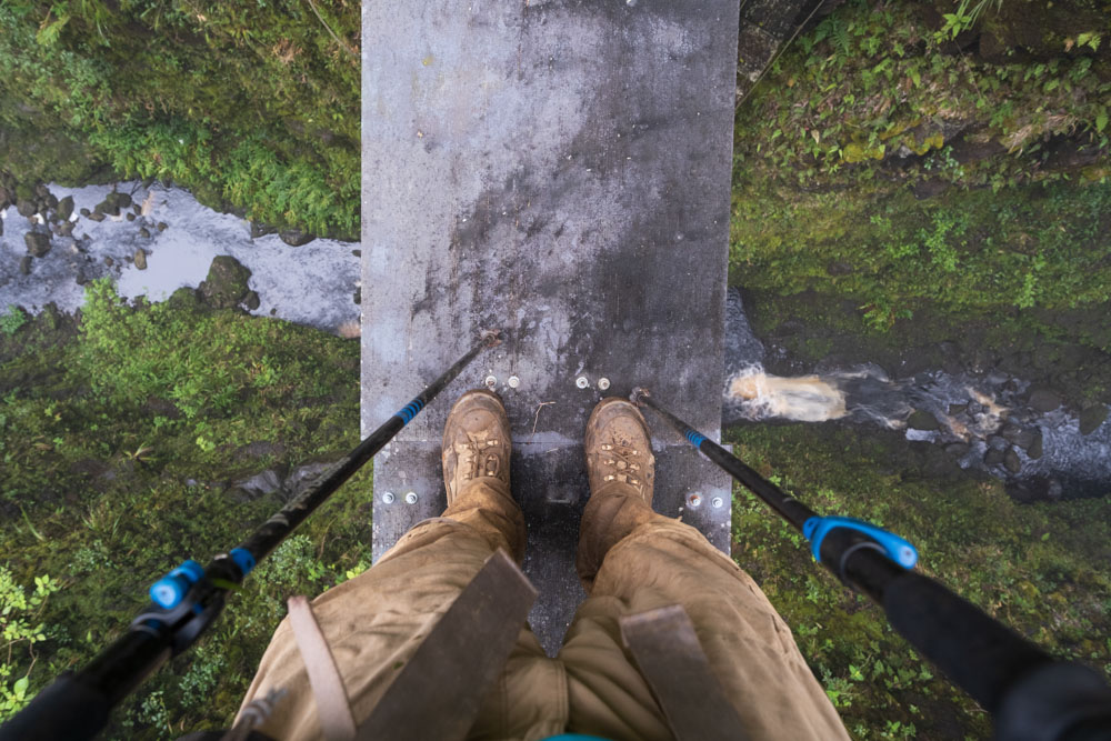
Chris and Jacob were already on the other side. I checked myself for anything loose or dangling, and then I shuffled as
softly as I possibly could across the bridge in order to minimize the swaying. The drop to the water below was far in
excess of 100 feet.
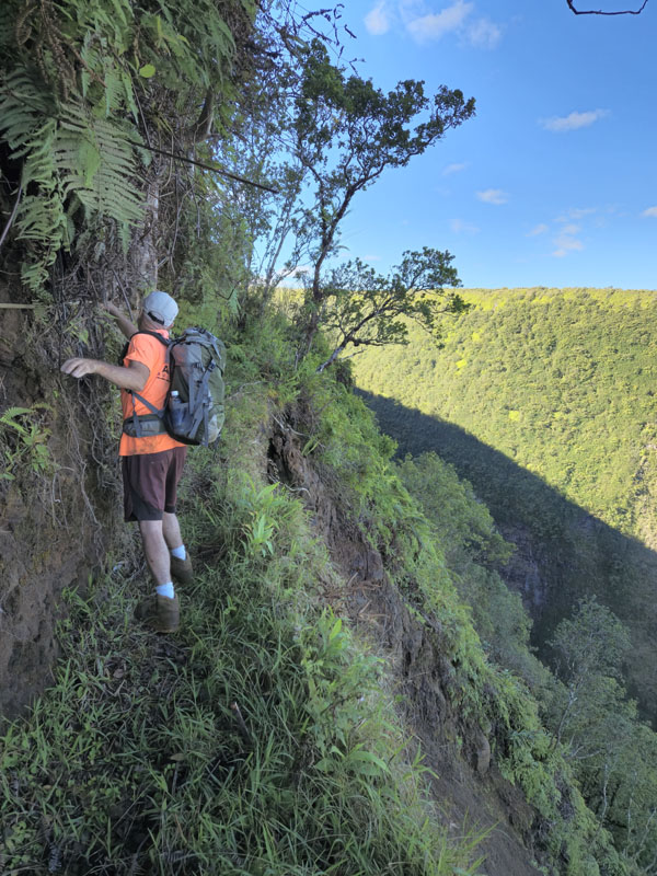
Once I had crossed the bridge, Jacob and Chris hurried off to the cabin on the rim of the valley that I had seen earlier. I
walked slower, stopping frequently to take photos. The narrow trail hugged the cliff face, and I carefully stepped over several
streams. In one spot, a landslide had removed part of the trail, leaving it perhaps two feet wide. I arrived to the cabin and
discovered it was called Kaukini. It had a trimmed lawn and a garden containing numerous herbs, and it was clear that a lot of
love had been put into the property. Its view into Honopue Valley was stupendous. As with the cabin I had seen that morning,
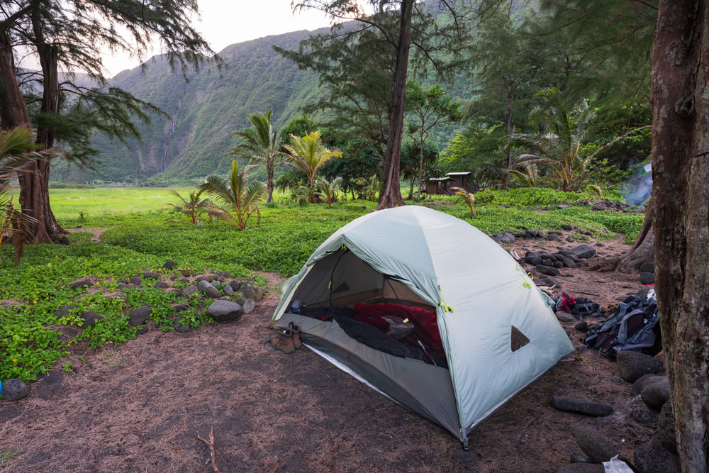
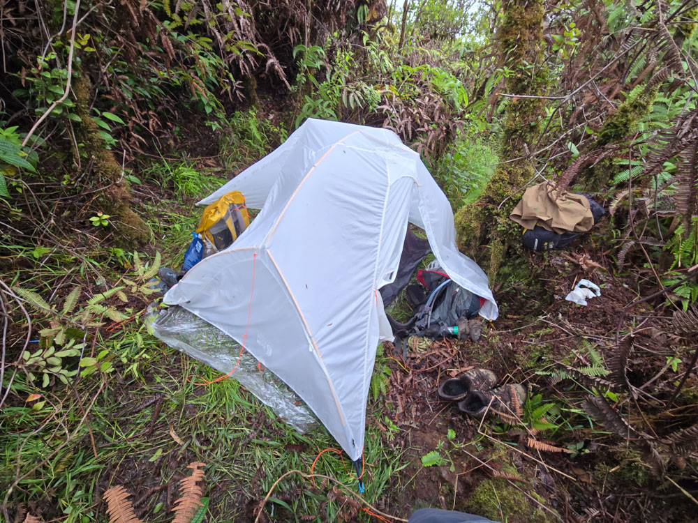
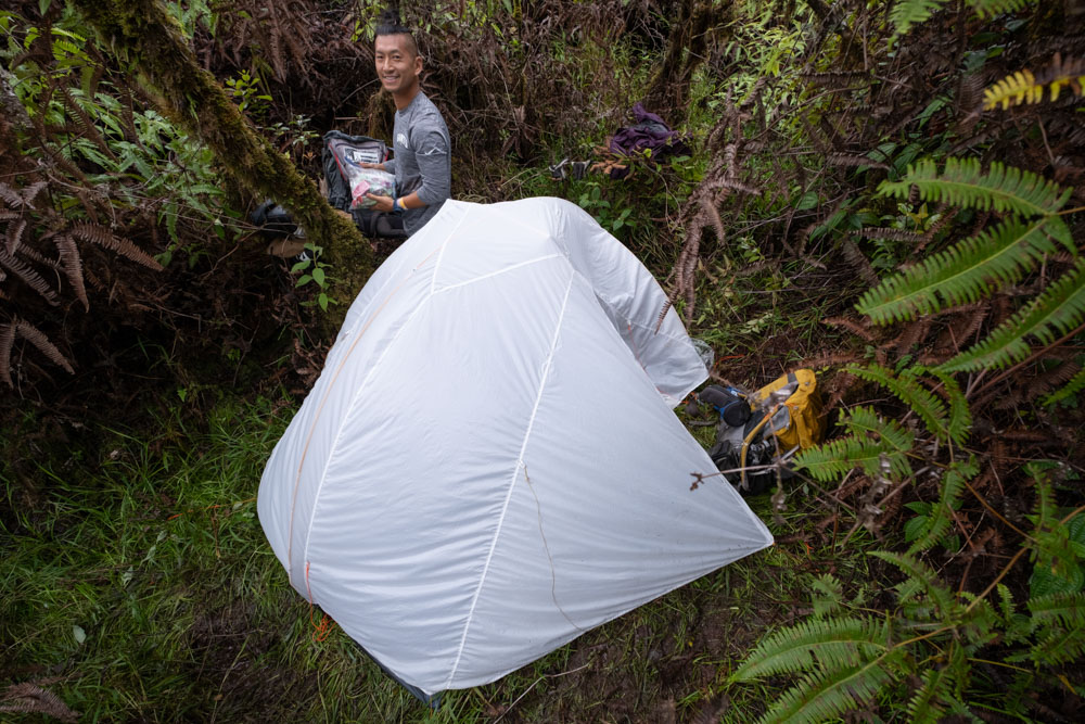
it was closed and locked. We cooked spicy Shen Ramen for dinner and camped nearby.
On day 1, I hiked for 10.5 hours. My GPS recorded 10.1 miles with 5400 feet of gain and 3800 feet of loss.
Jacob crossing above the landslide near the cabin.
Kaukini Cabin and Honopue Valley.
Day 2: Finding the route
I was nervous about what was ahead, so I slept poorly that night. After a rather interrupted four hours of sleep, my alarm
went off, and I arose in the darkness to prepare to be on the trail soon after sunrise. I had also slept poorly the previous
several nights due to stress and travel, so I was exhausted before the day’s journey had even begun.
Nonetheless, we set off on the Kohala Ditch Trail toward its end. The trail rapidly dropped in quality; it was clear that few
people ventured beyond Kaukini Cabin. The trail was quite overgrown, uneven, and pockmarked with mud puddles. We followed the
trail as it wound in and out of the gulches. There was another suspension bridge over a deep gulch. My general plan was to
depart the trail just before (west) of the Waikaloa Creek and then follow the ridge mauka. Waikaloa was the start of the Kohala
Ditch. However, I was unsure of where exactly to depart the trail. After 2.5 hours of hiking, we approached Waikaloa. We investigated a few
pig trails that ascended from the KDT, but they all had low branches and dense bushes that made them impassible to humans.
Chris and Jacob said that the KDT continued past Waikaloa, but they had never crossed the river, so they didn’t know the
condition of the trail past it. I was skeptical of hiking up the ridge on the east side of Waikaloa, but since we hadn’t found a
good route up the west side, I figured we should consider the possibility. Chris and Jacob took off their boots, waded across,
and climbed out of sight up some ropes on the far side of the gulch. I paused at the bottom to filter drinking water for myself.
It was raining rather hard, I was low energy, and I had a headache from caffeine withdrawal. I’m normally pretty dependent on
coffee, but had quit it for this trip in order to get hiking sooner in the mornings. I tried my usual strategy of jumping from
rock to rock across the river. The rocks were moss-covered and far more slippery than I expected. I jumped, landed with both
feet, and one leg launched off the rock into the river. I started to pitch over and, faced with the imminence of going
torso-first into the water, swung my other leg off. I stabilized myself in the thigh-deep water and then waded the rest of the
way across.

Mentally, this was a low point for me. My Gore-Tex boots, which I had taken pains to keep dry until now, were filled with water.
Given the rain and humidity, there was no possibility that they would dry on the trip. Gore-Tex keeps water out… until it keeps
the water in. I was going to have soaking wet feet for however many days remained. I was exhausted from the long-term sleep
deprivation and depressed from the caffeine withdrawal. The heavy rain and wet feet were bonus demoralization.
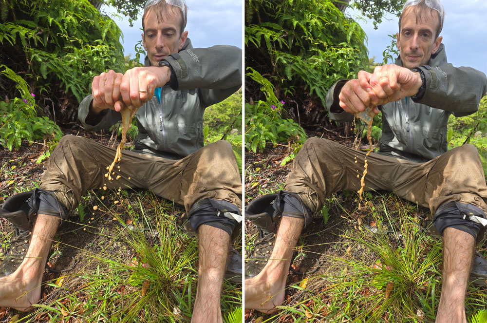
I did the only thing I could do: I poured the water out of the boots, wrung out my socks, ate a snack, and then hurried to catch
up with the others. They hadn’t gone far. After the first hundred feet, which had fallen off the cliff and then been
reestablished with ropes, the trail had been constructed with high-quality stonework. However, it had a wall of uluhe (a
Hawaiian fern) growing across it. It was impenetrably dense. Chris took Jacob’s machete and, with major effort, cut a path 60 or
so feet down the trail. However, the trail was heading maikai (toward the ocean) instead of climbing toward the ridge. It was
clear that no one had gone this way in decades. Given the wrong direction of the trail, the duration of its neglect, and the
extreme difficulty of progress down it, we turned around.
After the trip, I did some research on the trail beyond the Waikaloa gulch. Since this creek was the start of the Kohala Ditch,
there was no need for a trail past it. However, after the ditch began operation, there were proposals to extend it and increase
its flow by diverting more streams. This trail must have been constructed during the planning of the ditch extension. I found a
description of hiking it in a
1949 article in Boy's Life,
the Boy Scout magazine, and a map of it in a 1974 book about
Kohala water resources,
which I reproduced below.
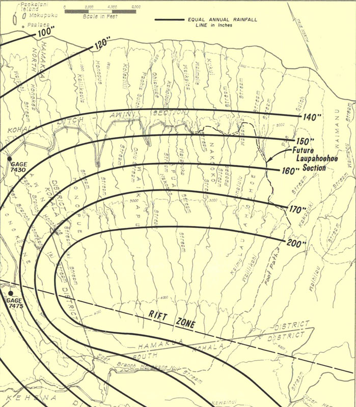
In the satellite view, I think I can see a few remnants of this Kohala Ditch extension trail. However, in most places, it has
completely overgrown, and the bridges for crossing gulches surely have fallen into the abyss. I don’t think it is a viable modern
route to Waimanu Valley, even if one carried a gas-powered hedge trimmer.
We departed from the bottom of the Waikaloa gulch, walked back the way we had come, and searched
more intently for a path up the ridge. Chris pointed to a hole
in the bushes that we hadn’t noticed before. "Do you think this could be our route?" he asked. I shrugged, still exhausted
and demoralized. "Drop your pack and
check it out," I suggested. I sat down, tired, and tried to summon energy while he disappeared up the hill behind me. After a
couple minutes, I heard a yell: "There’s a ribbon! This is it!" I threw my pack on and scrambled up the hill, passing Chris as
he came down to retrieve his backpack. Jacob announced he was turning around, we shook his hand, and then Chris and I ascended
the ridge without him. It was now 1:15 PM.
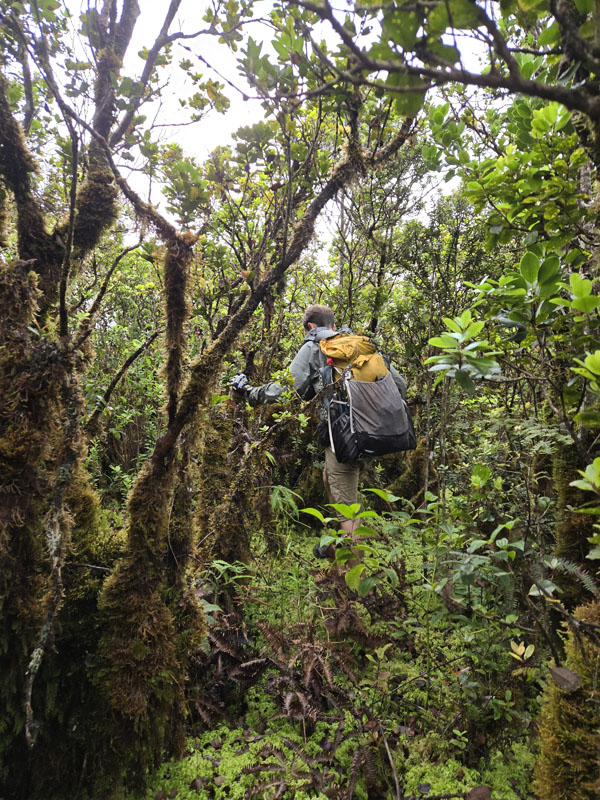
Our progress was extremely slow. The ridge we ascended was badly overgrown and extremely dense. We zigzagged back and forth,
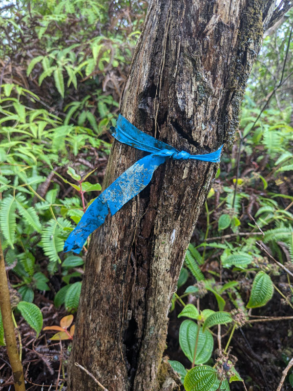
climbing over and crawling under branches. However, we found a ribbon tied to a tree every hundred feet or so, so we knew we were
on a route that had seen people before. The plastic ribbons were brittle and clearly had been there for many years. We reasoned
that the only possible destination of this route could be the trail network two miles above us. We were hopeful.
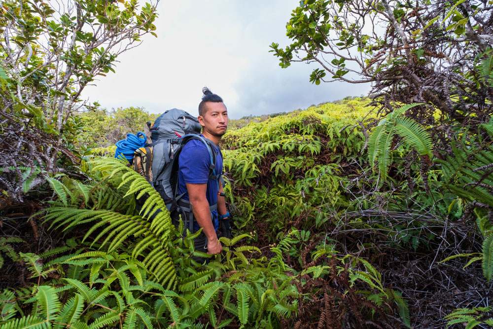
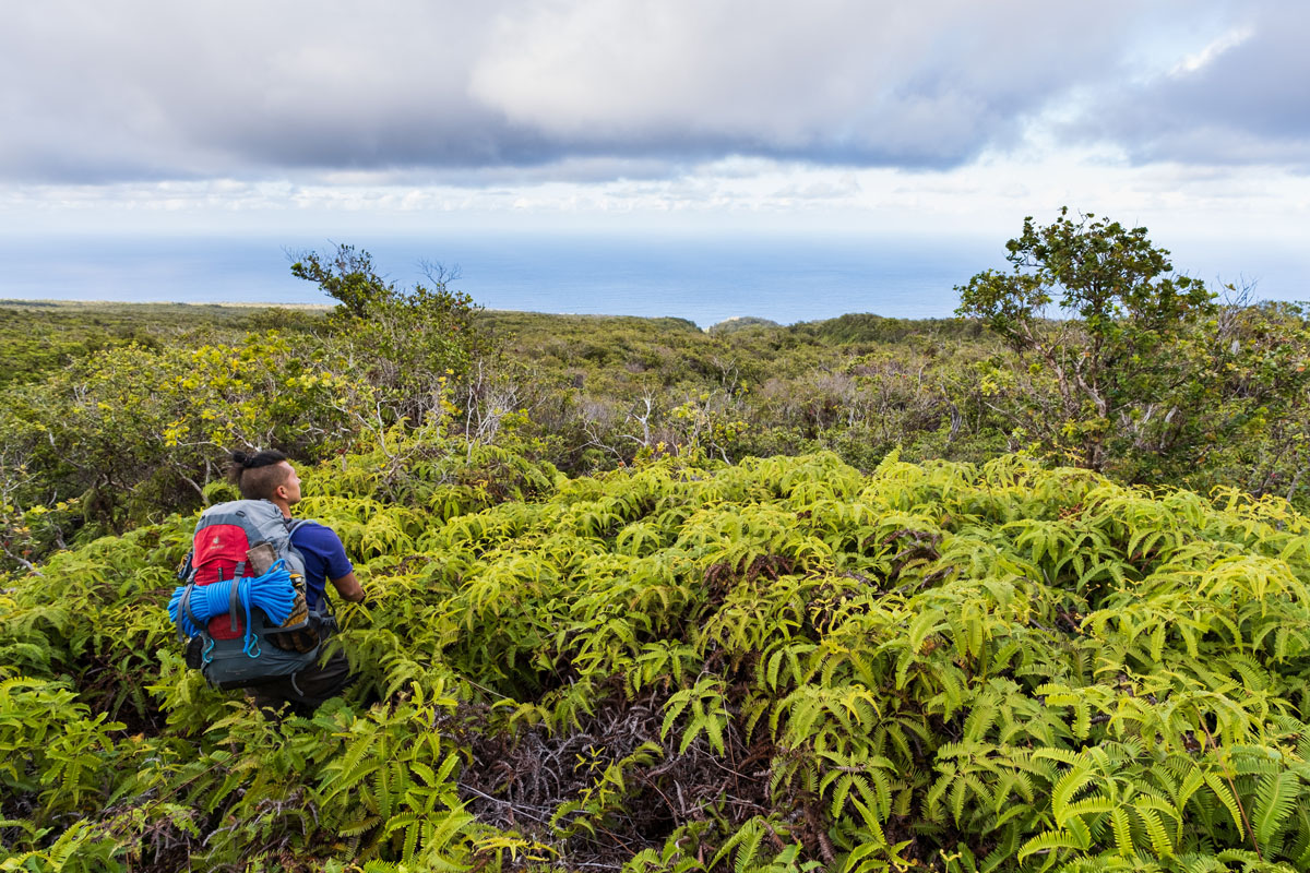
The bushes and trees of the first quarter mile gave way to uluhe ferns. Our progress slowed further. The uluhe was 2-3 feet
deep, but frequently concealed ruts or tunnels, so we often sank in deeply. It was nearly impossible to tell what existed below
the uluhe until one stepped on it. The person in front expended far more energy than the person behind due to having to shove
down the uluhe. The soft uluhe made ascending the ridge feel like a treadmill. We constantly turned around to attempt a route a
dozen feet to the side in hope that it would be easier.
We pushed hard and didn’t take any significant breaks. Based on my careful studying of satellite imagery, I thought we would
encounter vague paths up the ridge. However, those turned out to be mud puddles and dozen-foot sections of pig trails that my
mind had optimistically and incorrectly connected. After two hours and 45 minutes of hard work, we had covered two thirds of a
mile up the ridge from where we left the KDT. That was a pace of 0.25 miles per hour! We encountered a new problem: the uluhe
was so dense and deep we couldn’t find a route forward. After a period of choosing a direction, pushing that way, and then
retreating in defeat, we were frustrated. I took a running leap into a clump of uluhe in hopes of crushing it down to a state
where it could be climbed. Instead, I simply sank into it and stopped, and my feet didn’t even touch the ground. I was entirely
stuck. I yelled for Chris, and it took several minutes of flailing before I was freed.
After catching our breath, it was Chris’s turn to try to find a path forward. He took out his machete and started hacking at
the bushes. Shockingly, it worked. We moved forward with surprising ease. We had spent 40 minutes in that one spot. We started
making progress again.
We pushed forward for another 15 minutes, covering a hundred yards. By this time, it was 4:45 PM, and we stopped to discuss
our situation. We had been hiking for 9 hours, of which 3.5 hours had been spent covering 3/4 mile up the ridge. It was 1.1
miles to the point where we could cross Waikaloa Gulch, and then we would need to climb up the other side. From the satellite
view, it looked like there might be some clear spots amenable to setting up a tent in 1/3 mile. However, at our current pace,
that was hours away. A more pressing issue was drinking water. I was down to a quarter liter of water, which was enough for
perhaps an hour more. It looked possible to descend into the small gulch to our right for water, but given how dense the bushes
were, that could take an hour or more, and we would still be many hours from a plausible campsite. This section had been much
worse than anticipated, and the vague trails that I expected didn’t exist at all. Was I wrong about the existence of the trail
network ahead? Would bushwhacking down the 3000-foot vertical fin into Waimanu be this bad?
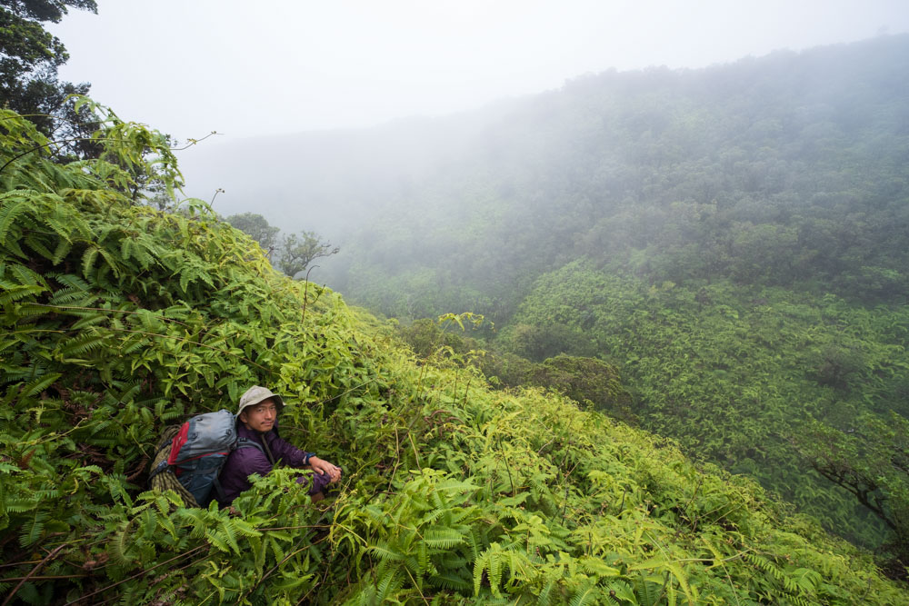
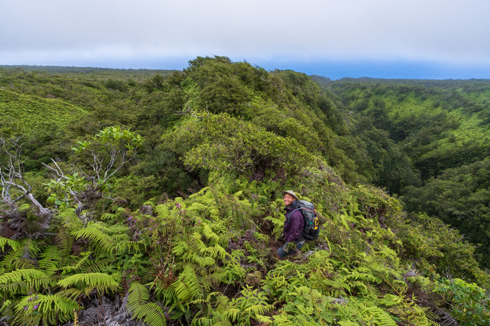
"Given all this, do we want to keep going?" I asked Chris. "I dunno," he said. We paused for a couple minutes. I was
exhausted to my core. "Let’s head
back." I took a photo of Chris leaning on some uluhe to demonstrate the terrain we were facing, and then we turned downhill.
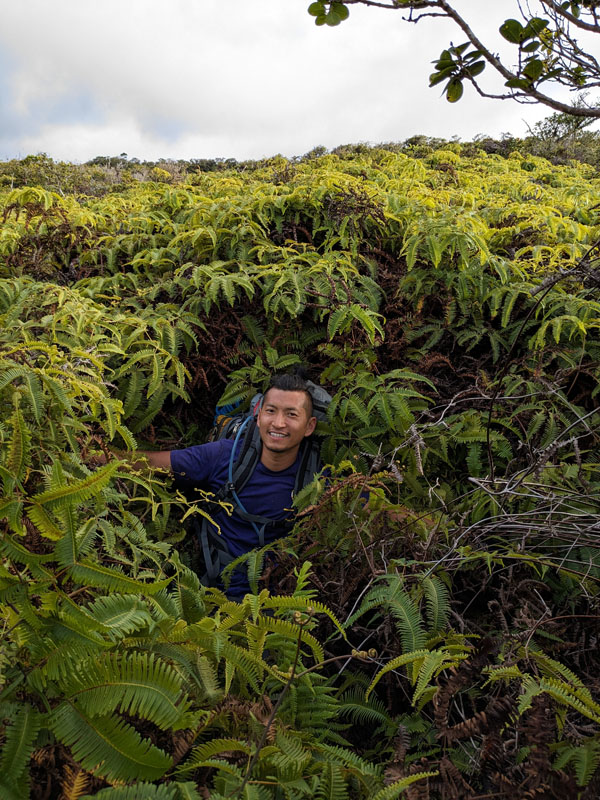
Chris is smiling in this photo, but that’s not how we felt.

It was far, far easier to bushwhack downhill than it was to bushwhack uphill. The gravity worked in our favor instead of
against us. Also, we were more skilled at getting through the bushes and trees. We arrived back at the KDT in 1.5 hours,
which was two hours less than we had spent going uphill. We arrived at the bottom just as darkness fell. We didn’t stop
until we reached the first stream crossing. There, we filtered and chugged water and then made dinner, huddling in
steady rain. We were quite exhausted from the day’s journey and spent an hour there.
Finally, we hiked on for another two hours to Kaukini Cabin. It was 10 PM when we arrived. Jacob was still there. "After
seeing the terrain you started up, I knew there was a good chance you would come wandering back late at night," he said.
On day 2, we hiked for 14.5 hours and covered 8.7 miles with 3600 feet of elevation gain and loss (each).
Day 3: Retreat
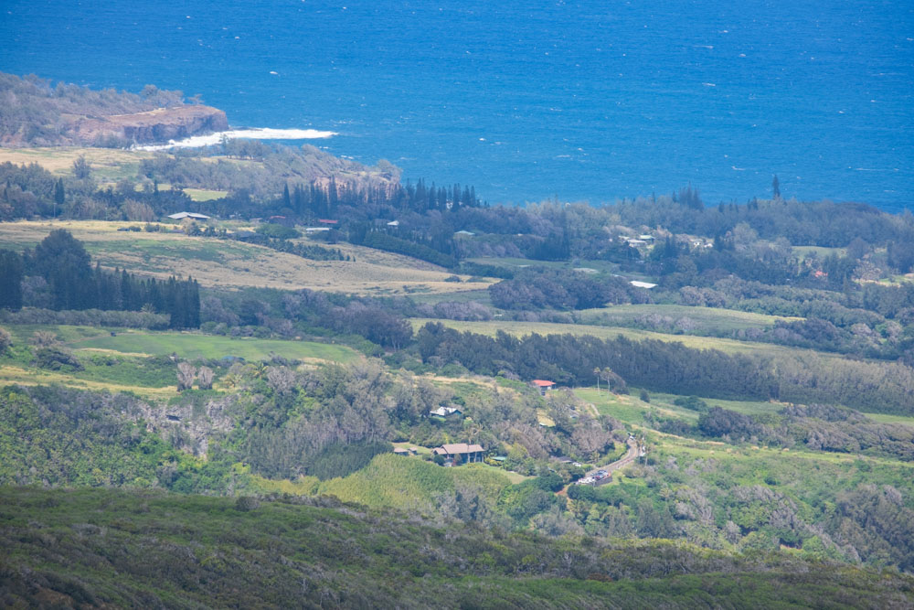
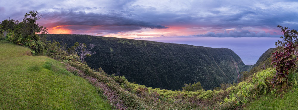
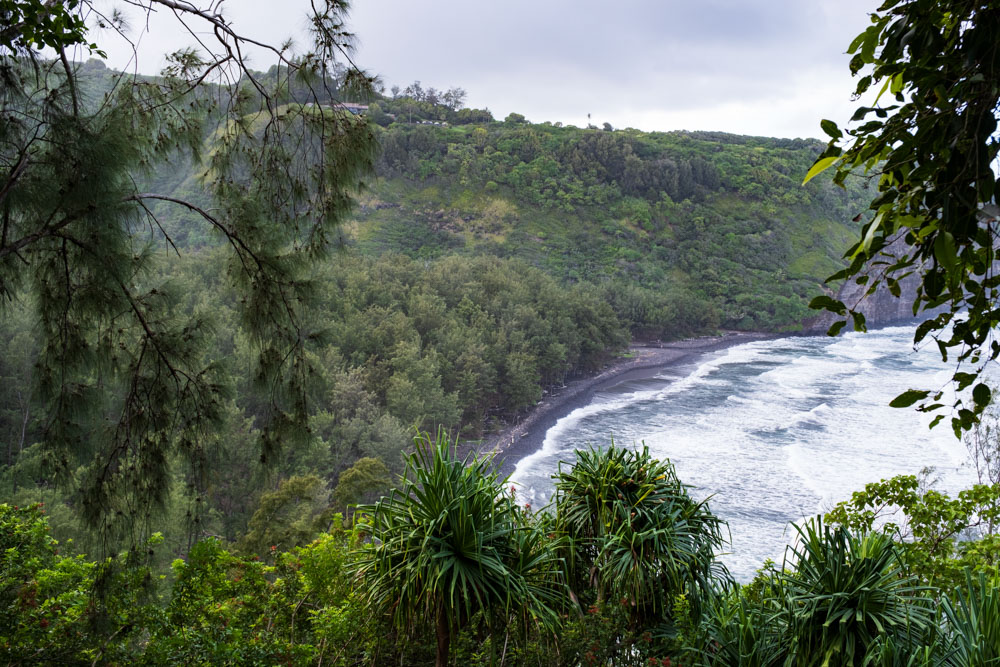
On the third day, we retraced our route from the first day. The weather was the best it had been all trip. We visited a lookout
point near Hale Awini, the cabin above Honokāne Iki, and it had fantastic views toward Pololū. We covered 10.9 miles over 9 hours with 5400
feet of loss and 3800 feet of gain.
The wide view (above) and a telephoto shot (below) toward the Pololu parking area.
I was in pretty good shape, but toward the end of the hike my body had had enough. I rolled my ankle a couple times on the
uneven, bush-obscured trails, and it was hurting significantly by the time I reached Honokāne Iki. Ankle pain has been a recurring
problem for me on long trips, and I was surprised it appeared after just three days. I was covered in scratches and was just
drained. The crawling and climbing down the horrible section into Honokāne Iki had confused my body’s balance calibration, and I felt a little wobbly. My pec muscles and
arms were sore from the unexpected amount of upper-body exertion. I made it back to Pololū without incident, but if we had
continued hiking up the ridge, I might have had problems.
Post-Trip
Chris and I didn’t really talk about another attempt while we were together in my remaining time on the island. While on the
plane home, though, I jotted down some notes to myself: if I make another attempt, I need to get a much smaller backpack so that
it catches on fewer branches. I need to lose 10 pounds of pack weight so it’s easier to scramble up the uneven terrain. I should
do tons of push-ups and burpees, perhaps while wearing a weighted backpack, in preparation for crawling through bushes. I should
practice lifting my legs to waist level in preparation for climbing over bushes, and I should practice stepping up onto 2+ foot
tall ledges. I should quit caffeine earlier so that I’m not going through withdrawal on the trip. Most of all, I need to
strengthen my ankles. I should bring gloves to protect my hands and glasses for eye protection. We should definitely carry a
machete and rope.
I looked at Google Earth and saw that the trail network we were trying to reach definitely existed, unlike the pig trails and
mud puddles I had falsely linked together up the ridge adjacent to Waikaloa gulch. I researched the overgrown trail we had started
on past Waikaloa and decided that it was definitely not a feasible route. We had started up the ridge quite late in the day, but
now that we knew where it was, we could start it much sooner. After my experience bushwhacking down the ridge, the fin in the back
of Waimanu Valley no longer worried me. I would carry more drinking water. It all seemed quite doable.
I called up Chris and explained this. "Do you want to make another attempt?" "Yeah, I’m down." We made plans to try again. We
scheduled a trip eight months after our first attempt.
In accordance with my notes, I trained much harder for the second trip. I went backpacking on strenuous routes through Death
Valley and Kings Canyon National Parks to build muscle, and I day-hiked 70 miles over three consecutive days on the Backbone Trail
in the Santa Monica Mountains. I bought a smaller, lighter Gossamer Gear
ultralight backpack, quickly came to love it,
and chose items to leave behind to lighten my load. My training was more intense than what I had done in 2020-2021 to prepare
for the Sierra High Route, a ~250-mile off-trail trek.
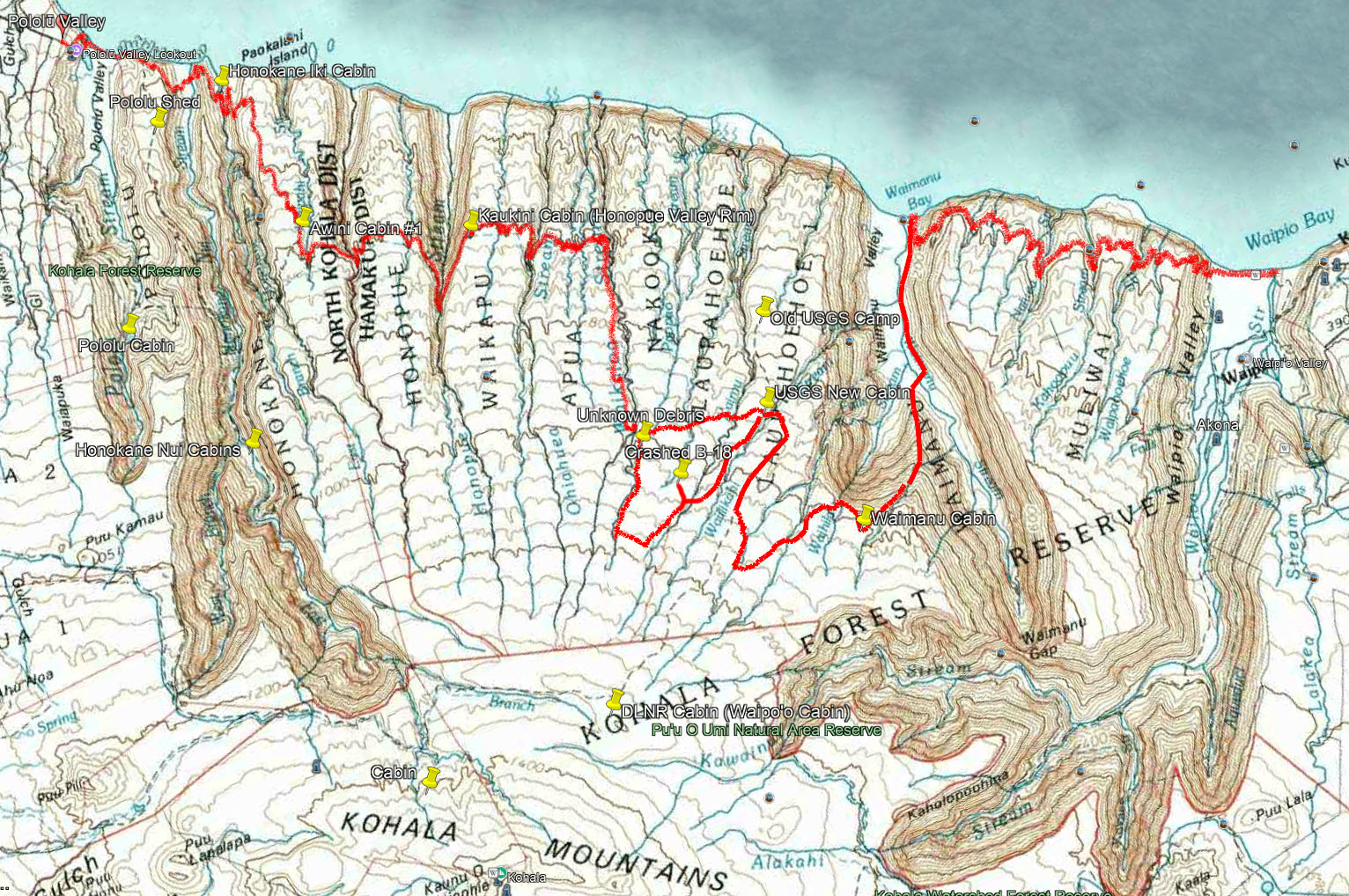
Our itinerary and route plan were basically the same as before. On Day 1, we would hike to Kaukini Cabin on the rim of Honopue
Valley. On Day 2, we would hike to the end of the KDT, up the ridge adjacent to the Waikaloa stream, cross Waikaloa, and then camp
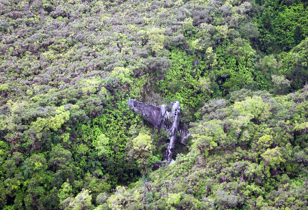
at the start of the trail network. On Day 3, we would visit the B-18 and camp at the USGS New Camp (there’s what the topo maps
call the cabin). On Day 4, we would hike to a cabin on the back rim of Waimanu Valley. On Day 5, we would descend the 3000-foot
fin into Waimanu Valley, hike the length of the valley, and camp at the beach. On Day 6, we would hike back to civilization at
Waipiʻo Valley.
I started feeling quite nervous about 10 days before the trip. I felt like my life had been leading up to this. I normally need
to sleep a lot, but each night I woke up after 5-6 hours of sleep, felt nervous, and was unable to go back to sleep. I was tired,
but also surprised that I managed to be functional at work; my body shifted to more productive but shorter periods of sleep each
night.
Day 1: As before
As before, Jacob joined Chris and me for the first day of the hike, and he didn’t plan to continue with us beyond that. Our journey
on the Kohala Ditch Trail to Honopue Valley went smoothly. Unlike the first time, we didn’t get rained on. After the trauma of
falling in the creek on the first trip, I took off my boots for the stream crossings instead of attempting to jump from rock to
rock. Climbing out of Honokāne Iki was as miserable as ever, and there was frequent crawling under and climbing over fallen trees.
At one point during this slog, I heard a crack and looked up to see a cantaloupe-sized rock sailing through the air across the
trail at head height 10 feet in front of me. Jacob posited it might have been knocked off by a pig above us.
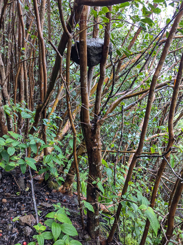
In another location, I noticed this football-sized rock lodged in a tree at head height. It must have fallen off the adjacent cliff.
Jacob and Chris went ahead of me as we approached Honopue, since I was taking photos. I arrived at the suspension bridge alone.
I crossed it, watching my feet and hands as I shuffled along. Just before the far end, I was startled by a gaping hole in the
bridge that I hadn’t noticed prior to crossing:
I gingerly jumped over this section. "Someone had a bad day and a close call," I thought. When I caught up with Jacob, he
suggested that it had actually been caused by a rockfall from the cliffs above. This seemed more probable than a person putting a
leg through the boards.
We hiked 10.4 miles with 5750 feet of gain and 4200 feet of loss over 10.25 hours that day. We camped near the cabin, and there
was a good sunset that night. I felt hopeful about the trip.
Day 2: My longest-ever hiking day
We woke up before sunrise and departed Kaukini sooner than I expected. Jacob did not come with us. There was unceasing moderate
rain. The trail past Kaukini was extremely overgrown, so Chris and I shoved our way through unending soaked bushes and stepped into
unforeseen deep mud puddles. I wore my Gore-Tex rain jacket, but within a short time it had completely soaked through. The water
wicked through my hiking pants into my wool socks, flowed down, and collected in my boots. I soon was experiencing the squish
squish of water-filled boots with each step. I had managed to keep my feet dry for one day, and they would be soaked ever after
this--just like on the first trip!
After 2.5 hours, we reached the edge of Waikaloa gulch near the end of the KDT. We filtered two liters of water each, departed
the trail, and started hiking uphill on the ridge. The rain stopped around this time.
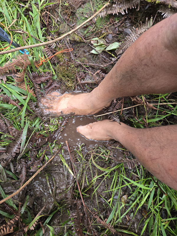
After half an hour, I paused to dump out the water that had seeped into my boots and wring out my socks. My feet felt much
lighter after this.
My headspace while climbing up the ridge was far better than at this point on the first trip. I knew what I was getting myself
into, I was less tired, I was stronger, and I had a lighter load. Chris and I made good progress. 2.5 hours after leaving the KDT,
we reached the point we had turned around on our previous trip. It was only 12:30 PM. For comparison, on the first trip, we hiked
up the ridge for 3.5 hours and reached this point at 4:45 PM.
Weirdly, the streamers that we had occasionally seen in trees stopped right around this point. We saw no more of them for the
rest of the day. We now pushed on into new territory. The narrow ridge we had been ascending flattened out into a broad slope, and
there were intermittent short sections of muddy grassland that we could hike through at more than our 0.5 mph previous pace.
We exited the uluhe ferns and grasslands and entered a dense forest of short trees. We needed to duck under branches, clamor
over roots, and shove our way through bushes. We regularly dunked our feet unexpectedly into hidden mud puddles. In places, the
ground was covered in soft moss that we sank into; each step felt like climbing a staircase. The flora was extremely dense, and
our hiking was very slow. When we had departed the KDT, I collapsed my hiking poles and strapped them tightly to the outside of
my backpack. During a snack break, I discovered that one of my hiking poles was simply gone. It must have been ripped off by
the bushes. They were pricey Black Diamond carbon fiber poles, so I was displeased.
This moss was a lot of work to walk through, but it was infinitely preferable to mud or uluhe.
Chris had a similar experience. He had started in the morning with a rain cover on his backpack, but it was ripped off by the
bushes and lost during this section of bushwhack. He was troubled by the prospect of rain seeping into his backpack for the rest
of the trip, but then discovered that he had accidentally carried a second rain cover. The disaster was averted by accidental
over-packing.
The next challenge was crossing the Waikaloa gulch. We would need to cross to the other side of this to reach the trail
network and our night’s campsite. There were sheer walls a couple hundred feet tall from the bluff we were ascending into the
water in the gulch. I had identified various points where the slope was reduced, and I knew from the topo map that if we hiked
up high enough, the gulch’s depth would reduce to just 60-100 feet.
At 4:30 PM, after 9 hours of hiking, we reached a stream. We were nearly out of water, so we filtered drinking water.
Running out of water would not be a concern today! I expected that we could descend this stream to the Waikaloa River, then
follow the river upstream one mile, then climb up the far side of the gulch to our night’s campsite at the start of the trail
network. I switched from my boots to my water shoes. Chris seemed skeptical of the feasibility and walked on ahead of me. I
walked in the water down the stream and rapidly caught up to him.
There was a 20-foot-tall waterfall. We scouted around the side of it and came to a 12-foot drop. It was vertical and sheer;
we wouldn’t be able to climb down it. "Should we rig up the rope?" I asked. "Let’s push up higher and find a better route,"
Chris said, "There might be a better entrance to Waikaloa, and we won’t have to walk up the river as far. Besides, there might
be another waterfall below this one."
Since we didn’t have rappelling gear, my intention with the rope was to use it to steady ourselves on steep terrain. I
wanted to keep my feet on the ground; I didn’t want to be dangling off the rope. We would have needed to slide down the rope
next to this waterfall, so I agreed with Chris’s recommendation. This was our first attempt to get into Waikaloa gulch.
We walked upstream and then scrambled up the steep slope to depart the stream. We continued ascending the bluff parallel to
Waikaloa, following close to the edge so that we could divert and drop down if we found a good spot. We diverted to a promising
potential entrance, decided it was bad, backtracked, and continued ascending the ridge. We found another potential entrance
half a mile after departing the stream.
The trouble was that we were pinned to ground level, but the terrain tended to curve downward, so we lacked perspective to
see the entirety of what was ahead. The gulch walls tended to become steeper near the bottom. This issue was compounded by the trees
and brush that further limited sightlines. When we stood on the gulch rim, we couldn’t see the wall below us to gauge its
steepness.
Despite this, we were hopeful about the hillside below us, so we pushed downward. We descended through the uluhe perhaps
150 vertical feet. At this point, the slope was around 45-50 degrees, so it was getting tough to scramble. We reached a small
tree. Chris paused there, and I dropped down another 20 feet. It was getting steeper, and I was concerned about the difficulty
of getting back up.
"Throw down the rope!" I yelled up. Chris tied off the rope to the tree and threw down a tangled knot of rope. I spent a
few minutes untangling it, and then threw the rope down the hillside below me. Holding the rope, I descended another 50
feet.
The rope was 100 feet long, and at this point I was about 30 feet from the bottom of the gulch. However, the slope was at
least 70 degrees and still getting steeper. I couldn’t exactly see the bottom, but I think the rope was just long enough to
reach it. If I slid the rest of the way down, there would be two problems. First, I was uncomfortable with how steep it was
getting, and I would be violating my "don’t hang solely off the rope" rule. Second, due to the length of the descent, we
wouldn’t be able to retrieve the rope. We had discussed the possibility of leaving the rope tied to a tree and were willing
to do so, but we were still early in the trip, and I didn’t want to be without a rope so soon. There were more gulches to
cross ahead.
Given these considerations, I reluctantly started hauling myself back up the rope. It was a dynamic rope (meaning it
stretched), so when I pulled it two feet toward me, I only lifted myself six inches upward. This made climbing up the rope
far more tiring than it needed to be. My pack weight didn’t make the climb easier. I made a mental note to carry a static
rope on any future trip that had the likelihood of needing to climb up it. With significant exertion, I finally climbed to
the top. Chris coiled it while I rested. This was our second attempt at the descent.
While we did this, fog rolled in. The far side of the Waikaloa gulch disappeared from sight. The sun had set and the light
rapidly faded. With additional major effort, we scrambled back up to the flat part of the bluff. We pushed onward in the
dark, again trying to parallel the Waikaloa stream. However, the trees were so dense and there were no landmarks to keep
us oriented, so we repeatedly failed to maintain our heading. We walked in a big circle. "We need to stop for the night,"
I said. "We’re just wasting energy at this point."
We encountered a stream and stopped there to make dinner. I hadn't realized until now how tired I was. We ate
freeze-dried meals while it rained on us and we became
further drenched. I was so tired I could hardly eat. I ate less than half of my meal and then couldn’t continue; I saved
it for later.
We continued on, looking for a campsite. At 11 PM, after another 20 minutes of wandering, we found a vaguely flat,
vaguely clear, vaguely tent-sized patch of muddy grass. It was not level. This would be our campsite. We pulled out our
gear and set up the tent while occasionally sinking ankle-deep into the mud. The spot was too small to fully extend the
vestibules. The tent looked slack and wrinkly because we couldn’t pull it tight, but it would do. We crawled inside and
passed out. It was midnight.
We had hiked 15.5 hours that day and covered 5.3 miles, 2620 feet of gain, and 1470 feet of loss.
It rained hard most of the night. At 2 AM, after two hours of sleep, I woke up hungry. I realized that the tent had
slid downhill, out from under the rainfly. My feet were no longer protected and were getting rained on. I got up, woke up
Chris, and pulled the tent back uphill and under the rainfly. I re-staked it, then climbed inside and ate the second half
of my dinner.
Day 3: A fateful decision
Due to our late bedtime and extreme exertion the day before, we slept in until 7 that morning. Because of the dampness
and poor campsite, we slept poorly, only managing 4-5 hours of sleep.
Despite this, we woke up feeling optimistic and ready to go. We were nearly to the top of Waikaloa Gulch. The topo map
showed that it would only be 60 feet deep here. We could cross it, and then we would be at the trail network. We thought we
would accomplish this the previous evening, so we were behind schedule, but nonetheless we thought we could do so quickly.
We could skip the B-18 and follow the high-quality trail to the USGS New Camp, which would put us back on schedule. "We can
get to camp by 1 PM today and then take a nap and dry gear." I told Chris. We put on our wet clothes and started hiking at
9 AM.
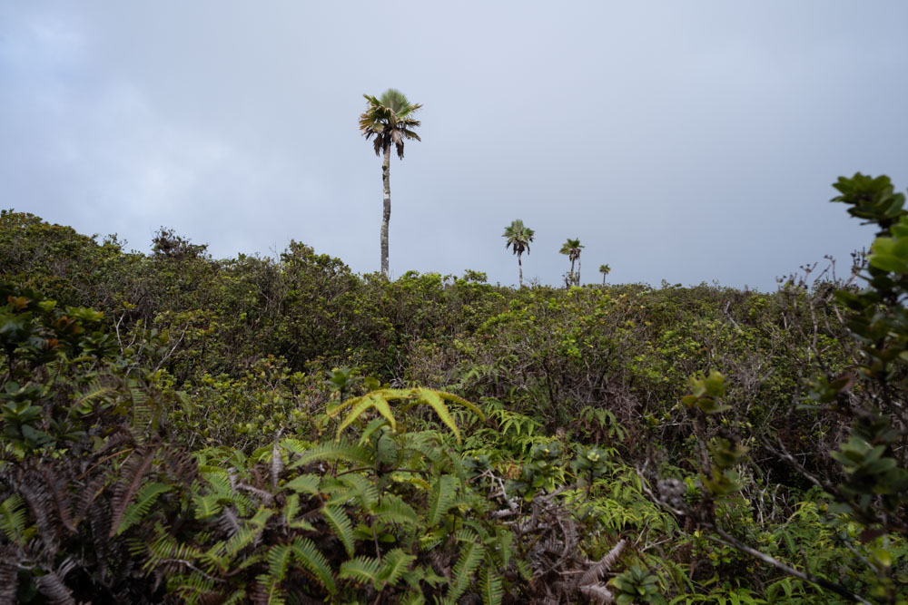
We hiked past a series of palm trees that were exactly in a line. They were equally spaced with a couple hundred feet
between each. They seemed human-placed, but there was no evidence of a trail in their vicinity.
We arrived at the rim of the Waikaloa Gulch again. It forked into a Y. If we hiked any farther up the ridge, we would
have to cross two gulches instead of
one. After a short and nearly vertical climb down some uluhe that was actually a bit fun, we reached the edge of the cliff
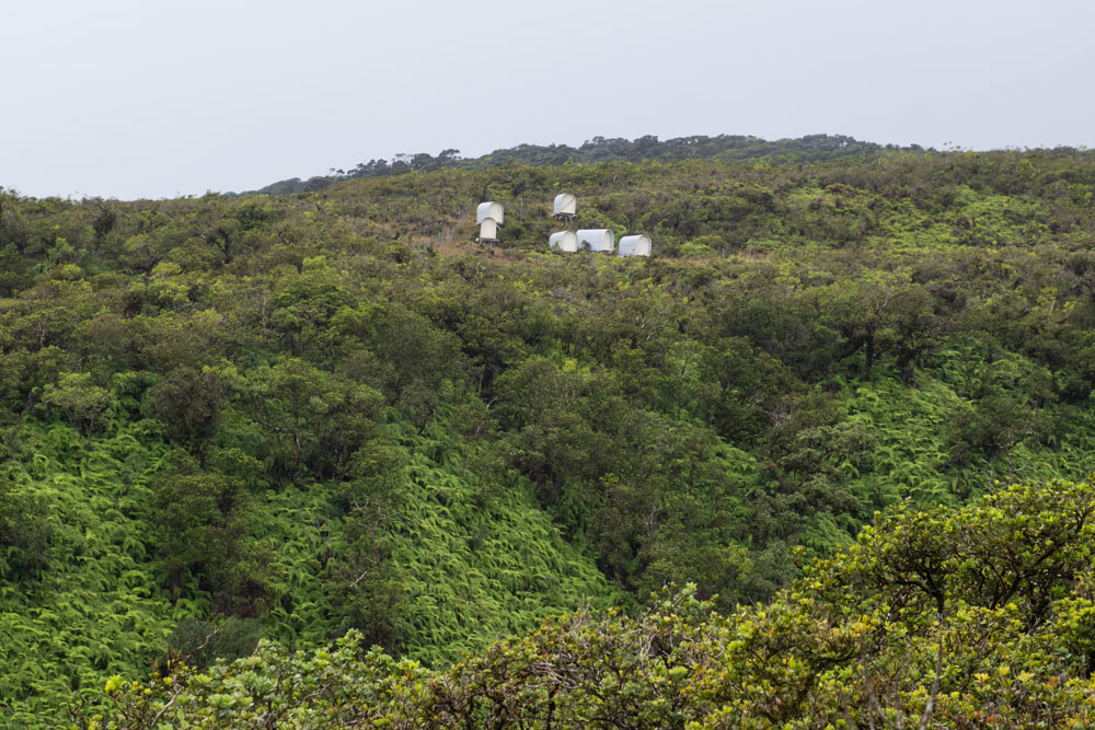
above the stream convergence. At eye level across the gulch, just 200 feet away from us, there were six small canvas sheds.
This was the start of the trail network. We just needed to get there.
There was a significant problem. The topo map showed that the gulch was only 60 feet deep here, but that was completely
wrong. From the flat bluff to the bottom of the creek was probably 300 feet. Half of this descent was gradual and easy, but
the last ~150 feet was steep. The gulch was narrow enough that it hadn’t been mapped correctly. As before, the steepness of
the valley walls increased near the bottom. This made the stream directly below us consistently out of sight, so it was
difficult to assess the terrain.
We were at the edge of a cliff where Waikaloa branched into two streams. We couldn’t climb down directly to the water.
It was clear that we needed to traverse downstream and find a less steep entrance to the water. We could then walk in the
water a short distance up and then somehow climb up the other side of the gulch through the bushes to the sheds. Chris
carried a DJI Air 2 drone to document our journey and help scout paths for us. He launched it from his hand and I watched
the controller screen over his shoulder. As we surmised, around the corner downstream from us, the slope of the hill
decreased. We decided to traverse a hundred yards through the dense uluhe along the hillside.
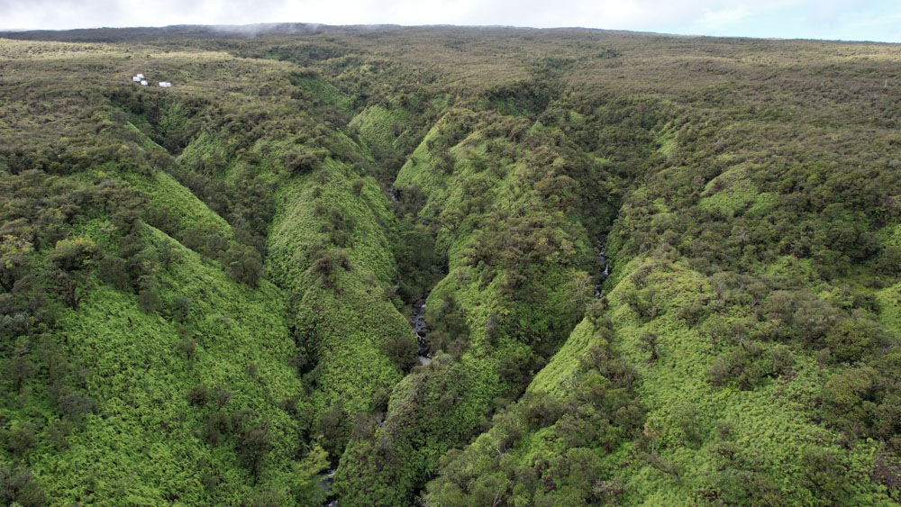
We were off the bottom on the right of this photo, and we needed to get to the cabins in the top left.
With extreme difficulty, we did so. There was frequent falling through the bushes, and we took turns breaking trail
every 50-100 feet. It was easy to descend, hard to maintain elevation, and even harder to ascend. The video below is
representative of the terrain.
We reached the grove of small trees we were aiming for. I climbed up into a tree in order to better view the
hillside below us. It looked steep. Chris and I spent several minutes sitting and discussing our options. This looked
doable in the drone video but not doable in-person. This was our third attempt to drop to Waikaloa.
Chris launched the drone again and scoped farther downstream along the ridge. We found a better route another 200 feet downstream,
though it still seemed pretty steep. We were too low to traverse, so we needed to climb uphill. With significant struggle,
we ascended the ridge a bit and then traversed to that point.
We sat down in the uluhe. "Is this really the route we wanted? This doesn’t look good." Chris launched the drone a
third time, and we closely studied the path before us on his screen. "Yes, this is what we identified. It’s not going
to get better than this." He recovered the drone and we sat there, pondering the next steps. "This seems doable. Let’s go
for it." I said. This would be our fourth attempt to drop to the creek. Neither of us moved.
A wave of exhaustion hit me. The four hours of sleep the previous night, the extremely long days of hiking, and the
sleep deprivation before the trip seemed to suddenly catch up to me. We looked down into the stream. The water was
fast-flowing and it wasn’t shallow; the river had swollen from the heavy rain over the last two days. "How will we walk up
the stream? That could be really difficult," Chris said. "If we can’t ascend the other side, I don’t know if I have the
energy to climb back up this way. Going up will be way harder than going down." I said.
"Do we want to turn around?" I asked. "I dunno," said Chris. "Honestly, this looks pretty bad," I said. We sat there
for a long time. "Let’s turn back. This is too sketchy." We took some photos. The canvas sheds were just a couple
hundred yards away, but they seemed unreachable. It was 1 PM. We started hiking back the way we had come.
Did we make the right decision to turn back, or was it just caused by a wave of tiredness that hit both of us? This
question haunts me. Honestly, I’ve faced worse terrain before in my previous adventures. I pushed ahead in those cases
because I knew I was on a route that humans had traversed before. Here, though, we didn’t know where exactly people had
crossed before. Could we down-climb to the river? The answer was probably. Could we walk upriver in waist-deep water and
not need to swim with our backpacks? Again, probably. Could we find a route up the far side of the gulch and the energy
to climb it? Probably. But if any one of these three assumptions failed, we would have been in a horrible situation.
Rescue would be days away, and we would probably freeze in the water before then. Given this, turning around seemed
prudent.
The initial hike back was extremely difficult. Bushwhacking steeply uphill was miserable and tough. We tried to follow
our previous path as much as possible, but we had to divert around too-steep sections. After several hours, we reached
the stream that we had first tried to follow down to Waikaloa creek. We filtered water and made dinner. Chris found a
flat-ish spot that was almost as big as the tent. We decided to camp there. He used his machete to cut moss and level the
campsite. It wasn’t great, but it was far better than the previous night’s campsite. We went to bed early that night. We
slept for a long time.
On Day 3, my GPS claimed we hiked 1.2 miles, 400 feet of gain, and 600 feet of loss over 8 hours.
Day 4: Downhill through the bushes
On Day 4, we generally retraced our route from Day 2. Since we knew that bushwhacking downhill would be easier than
bushwhacking uphill, we weren’t in a huge hurry. We slept in, slowly packed up camp, and didn't start hiking until 9 AM.
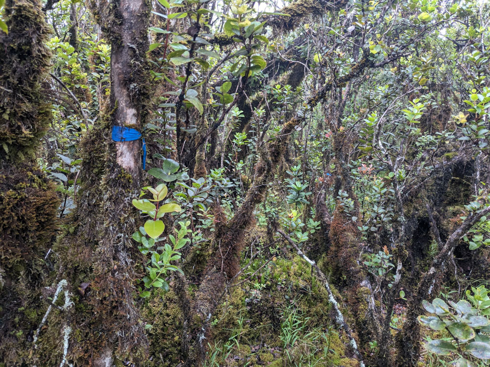
Shortly after we left camp, we noticed two blue streamers tied to adjacent trees. We hadn’t seen this on the ascent.
Someone had been up here many years earlier. These were the first streamers we had seen since passing the first trip’s
turnaround point. Whoever set out the streamers had a mile gap in them.
While wandering down along our previous path, Chris was overjoyed to find his backpack rain cover that had fallen off.
It had been pulled off by some bushes as he shoved his way through them two days earlier. I was not fortunate enough to
find the hiking pole that had been ripped off my backpack.
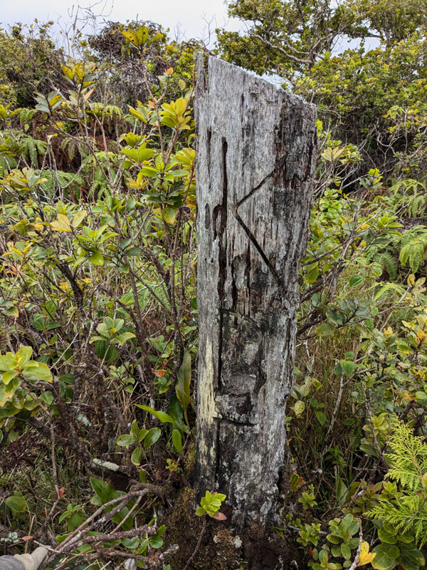
Around the point we turned around on the first trip, we found another sign of humans that we had missed on the ascent.
A tree trunk that had clearly been sawed down was etched with "KDF." Kohala Ditch… something?
The lower section of the bushwhack was worse than I remembered from two days earlier. I guess I had already succeeded
in repressing those memories. Chris and I made very slow progress and repeatedly needed to double back because we
encountered impenetrable bushes. The KDT was in such poor condition that I didn’t realize we were on it when we finally
reached it. I pulled out my phone to check where we were relative to our path from a few days earlier. "Chris, we’re at
the bottom! This is the trail!"
We followed the KDT for 2 hours. When we were 200 yards from Kaukini cabin, a downpour began. We ran the last minute
to the shelter of the cabin’s porch. We set up camp and spent the night. The heavy rain would continue for the next 24
hours.
On Day 4, we hiked 4.8 miles with 1500 feet of gain and 2500 feet of loss over 6 hours and 45 minutes.
Day 5: The failed hike out and a near-death experience
Hard rain fell all night. We probably should have just sheltered near the cabin all day. But after four days of "PRESS
AHEAD AT ALL COSTS," we weren’t feeling particularly cautious. We wanted to get back to civilization. We didn’t
consider the implications of the rain.
Chris and I packed up slowly in the morning. We weren’t eager to face the rain. I knew that my Gore-Tex rain jacket would
soak through in about 20 minutes, and then I would spend the next 9 hours hiking while increasingly drenched.
Finally we ran out of excuses to linger, and we departed the cabin at 9:10 AM. The first section of trail was cut from
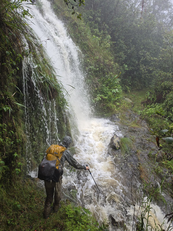
the wall of Honopue Valley and led to the suspension bridge. There were numerous waterfalls spraying off the cliff and onto
the trail. We giddily ran through them, awed at the volume of water crossing the trail.
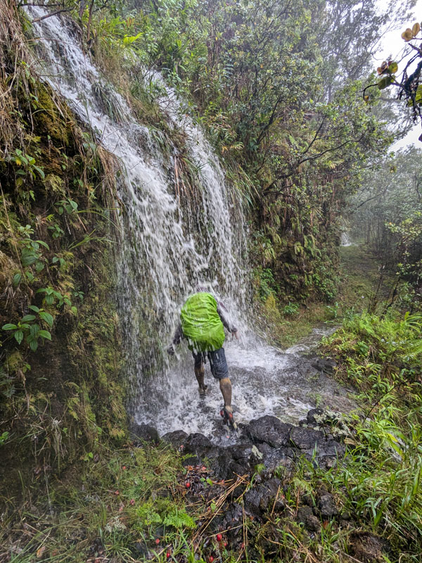
But less than half a mile from the cabin, we encountered our first problem. A waterfall produced a deep, raging stream
across the trail. The stream was elevated to the point that it swallowed the nearby plants. The water was brown, so we
couldn’t gauge the depth. On our right was the cliff--the stream sprayed off it as a waterfall. We took off our
packs and inspected the stream. While getting poured upon and with annoying slowness, I took off my hiking boots and put on my
water shoes. Switching from wet hiking boots to wetter water shoes was a pointless formality that I wouldn’t bother with
again for the remainder of the day. I took my remaining hiking pole and poked into the stream to gauge its depth.
After perhaps 15 minutes at the stream, I jumped to a shallow patch in the center, and then I lunged to the other side.
It wasn’t bad. Chris followed me, and we set off again. This was the sign of troubles to come.
Looking back at the stream after crossing it.
We paused only briefly at the suspension bridge to take photos. The rushing Honopue River was incredibly loud. We could
only communicate if we stood a few feet apart and yelled.
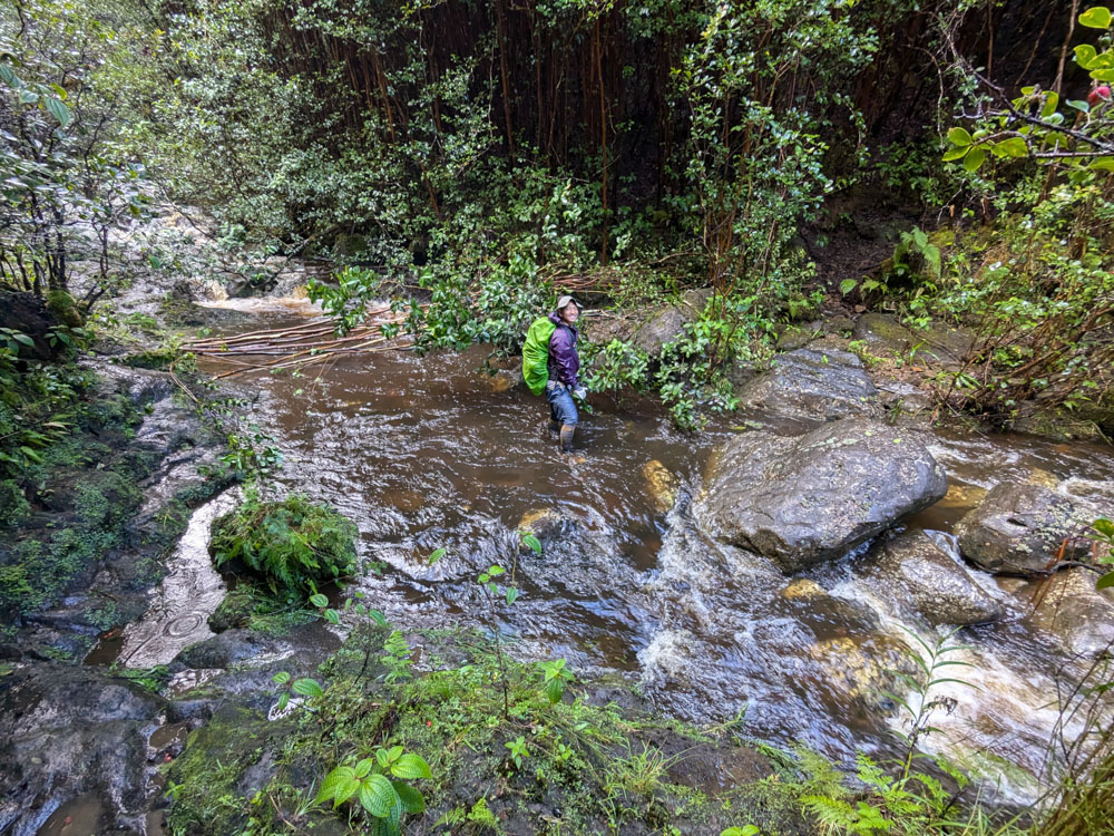
After 1.5 miles, we reached Kaʻilikaula stream. I proceeded to make what may have been the worst mistake of my life
here. On the first day of the trip, this had been trivial to cross, and I had jumped from rock to rock to keep my feet
dry. Now, it was perhaps 25 feet across, of unclear depth, and was fast-moving. There was a waterfall immediately downstream
of the crossing point. Why was the stream crossing immediately upstream of a waterfall? The Hāmākua landscape is so rugged
that there are waterfalls everywhere.
After some strategizing, Chris and I forded upstream a bit and then started wading across. I held my hiking pole in my
right (downstream) hand for stability. After a few steps, the current was strong enough that Chris and I held each other’s
wrists for safety and stability. We staggered into deeper water, each taking one step at a time. The depth steadily
increased, and by two thirds of the way across, the water level was above our waists. The bottoms of our packs were in the
water.
There was one more dodgy step, and then the next one would definitely be to shallower water. We were nearly across, so
surely the depth would improve. But it was impossible to gauge the depth due to the rushing brown water. I poked around
with my hiking pole, and it fully submerged each time. The depth seemed similar to what we were already standing in. "Can
you take a step?" I asked Chris. "I’m too unsteady, I can’t." "I’ll step. Hold onto my arm." I said.
I lifted my leg and immediately lost my balance. The water pushed me over sideways, and I disconnected from Chris's arm.
I jammed my hiking pole down and my arm simply disappeared below the surface. "Oh shit, this is it," I thought as I fell.
I literally have no memory of the next
moments. My next memory is hugging a boulder while kneeling in shallow water on the far side of the stream.
What happened when I lost my balance? I keep asking myself this. Did I lunge toward the boulder while off-balance and
in the process of falling? Did Chris give me a shove in the right direction as I went over? I’m genuinely not sure. I’m
also unsure how Chris crossed the stream after me.
My hiking pole hung in pieces from my wrist. It had snapped when I fell. I was greatly disturbed by what had just
occurred. "We shouldn’t have done that. We should have turned around. If we see another stream like this, we need to turn
back," I said when we were on the other side. Chris agreed. He was spooked and humbled too. We had proceeded with inertia
rather than stopping to consider whether we should actually attempt the crossing.
I ate a snack and we continued on. We crossed a few more knee-deep streams over the next hour. Then, 3 miles after
departing the cabin that morning, we reached Honokeʻa Stream. Honokeʻa forms a valley that’s bigger than Honokāne Iki
and nearly as big as Honopue. Chris was in front of me, and I caught up to him at the stream’s edge. The mass of brown
water rushed down it. "There’s no way we can do this," he said.
Honokeʻa was massively deeper and faster than Kaʻilikaula had been earlier. And its walls were vertical.
We walked back and forth, trying to find a plausible crossing point. It was all really bad. "We can’t cross this. Let’s
go back to the cabin and try again tomorrow."
It was now 11:30 AM. We turned around and started hiking back. The rain was still pouring down.
45 minutes later, we arrived back at the Kaʻilikaula stream. It was raging just as much as when we had crossed it the
first time. The crossing looked more difficult in this direction. I waded in to knee depth, felt the force of the water
against me, and turned around. "We are NOT doing this," I said. I didn’t want to repeat our mistake from earlier.
We set down our packs while considering the next steps. I made a mental note of the water height on some stones at the
edge of the river. I noticed a guava tree that had fallen down and was on the side of the river. It was 30 feet long,
perfectly straight, and didn’t have many branches. "Maybe we can use this to help us get across," I told Chris. I picked
it up, jammed it over a Y-shaped branch from a nearby tree, and pushed it most of the way across the river. It didn’t
reach the far side of the river and was mostly beneath the surface, but it held in place against the current and could
give us a handhold for some stability.
"We can do this more," I said. Chris liked the idea. He took out his machete and started chopping down guava trees.
He felled several, including one that was probably 50 feet tall and 6 inches wide. I also found another dead guava tree.
After perhaps 45 minutes, we had put 6 or 7 trees across the river. We lodged some of them between the boulders on our
side of the stream so that we would be able to cross with some trees upstream of us and some downstream.
There was one problem: I had been watching the water level since we first arrived here, and it was rising. The rocks
that were clear of the water when we arrived were now submerged. I was still chastened from our previous crossing; I
didn’t want to make the same dangerous mistake again. Even with the trees laid across the river, I didn’t want to attempt
a crossing in water levels that were higher than earlier in the day.
We had been in the rain for many hours at this point. We were thoroughly soaked. The air temperature was in the mid-60s
Fahrenheit. When we were hiking hard or dragging trees around, our body temperatures were ok. But I knew we would become
dangerously cold if we sat and did nothing. We were trapped between two streams that were 1.25 miles apart. We needed
shelter. We needed to get out of the rain and out of our wet clothes.
I walked a quarter mile up the trail and looked for a spot to set up our tent. I didn’t want to push much further up
the trail because then it would become difficult to check the stream’s level. The trail was steep, overgrown, muddy, and
narrow; it’s not the sort of trail that has many level, flat, tent-sized spots. I identified two possible tent locations,
but both were bad. The first was near the stream and just above its waterfall. It was very narrow, highly sloped and
deafeningly loud from the roaring water. Knowing that we might need to spend the night here, and it would be impossible
to sleep due to the slope, I didn’t like this spot. Also, the water’s roar made me nervous. The second possible campsite
was a bit farther away. It was level and big enough to partly extend the tent’s vestibules. The downside was that it was
breezy there. The campsite was on the crest of the hill and the trees provided only marginal shelter. Neither campsite
was good, but the second one seemed less bad.
We set up the tent as quickly as possible in the pouring rain, attempting to minimize the water that collected inside
it. We inflated our sleeping pads and put on our less-wet clothes (everything was pretty damp at this point). Since
exiting the tent involved getting drenched, we wanted to avoid that. We decided to wait for four hours and then go check
the stream level.
Chris wore shorts the entire trip. His legs got shredded during the bushwhack. This photo doesn't do it justice.
The wind increased, and the tent began buffeting violently. I ran around and tied off every possible guyline to give
the tent more anchor points and support. It wasn’t enough. The tent was an ultralight model, so its poles were thin and
minimal. (I had considered using an even lighter tent that relied on hiking poles for support. Since one hiking pole was
lost and the other destroyed, this would have been a catastrophic decision.) Even with the guylines, the wind repeatedly
flattened the tent on us. Chris and I pushed it back up with our hands. I feared that we might soon hear ripping sounds.
"If the tent shreds on us, we’re going to have major problems," I told Chris. We were trapped between two rivers in a
major rainstorm. We were warm inside the tent, but wouldn’t remain so if we had to sit in the wind and rain in drenched
clothes. If we lost our shelter, our lives would be threatened.
I had a Garmin Inreach, which could send texts via satellites, and I could use it to request emergency help. But no
helicopter would come in the winds. I had been texting a group of friends with our progress throughout the trip. I sent
a new message to them: "We’re stuck between Kaʻilikaula and Honokeʻa streams due to high water levels. Sheltering in
tent. High winds and rain. Pray for us. If tent shreds we’ll need rescue. Could wait long time otherwise." Shortly
afterward, I got a text from my mother saying that her church group indeed was praying for us.
There wasn’t much we could do, so we sat in the tent, pushed it against the wind whenever it started to collapse,
and hoped it wouldn’t rip apart. Chris and I discussed the next steps. "If we can cross this river and get to the suspension
bridge across Honopue Valley, we can enter the Kohala Ditch there and hike inside the tunnel for a few miles. It bypasses
both of these raging rivers, and we can exit near Awini Cabin, above Honokāne Iki. I’ve hiked this section of the tunnel
before," Chris suggested. He had a remarkable memory of ditch access points.
I had also hiked miles inside the Kohala ditch tunnels before, but not this section. "Will the water get deep?" I
asked.
"It can’t get that deep. There are points where the water will overflow and exit the ditch if it gets too deep,"
Chris said. This matched my experience. I had never seen the water get deeper than my knees in the tunnels, and I had
encountered these overflow points.
"What about the places where the streams flow into the tunnel? Won’t those be raging?" I asked.
"I don’t think so," Chris said. "When I hiked it before, there was no inflow at all. Now it might be a little
sketchy but we can probably push through them."
"Let’s see how we feel if we get back to Honopue. We can make the decision then. I might be so tired I want to get
back to Kaukini Cabin and sleep there. On the other hand, I like the idea of getting out tonight. We can make it back
to Pololu before sunrise." I said.
Chris agreed. "Yeah, see if you’ve reached your limit when we get back to Honopue," he said.
"I don’t know what my limits are. All my life, I’ve pushed so much. I don’t know where my mental and physical limits
are anymore," I replied.
Slowly the rain and wind reduced. They didn’t stop, but there were no longer sheets of rain and non-stop wind
buffeting. We could actually relax a little bit. Finally, after four hours in the tent, it was time to check the
stream’s level. Chris and I took off our merely damp clothes to preserve them and put on our sopping clothes. We walked
down to the stream.
The water level had dropped at least a foot, and its velocity had decreased. The rocks that I had been watching,
which previously were semi-submerged, were now clearly above the water’s surface. The trees that we had put across the
stream, which before had been mostly underwater, were now mostly above the surface. "The water level has dropped!
Let’s go for it!" I exclaimed.
We quickly packed up the tent, again trying to minimize the water that collected in it and in our backpacks. We
weren’t sure if we would need the tent again. Once our backpacks were packed, I waded into the water again.
I took a couple steps into the water. It was already to my knees. "Chris, we should link arms again." I said. I
took another step without him, holding the guava trees instead. It wasn’t bad. The speed of the water had greatly
decreased. I quickly crossed the river, and though it was thigh-deep, it never felt hazardous.
"That was much easier than I expected!" I yelled back at Chris. He followed behind me. I pulled out my InReach
and sent a text to my contacts saying we were no longer trapped. I felt immensely relieved.
Looking back at our guava tree handrails across the river after our successful crossing.
We started hiking back toward Honopue Valley and Kaukini Cabin. Half an hour later, we arrived back at the swing
bridge crossing the valley. The entrance to the ditch was here. The sun had set and twilight was upon us. I liked
the idea of getting back to the trailhead that night; I could catch a plane the following day home. After a short
discussion with Chris, we decided to attempt the tunnel route out. We put on our headlamps and climbed into the ditch.
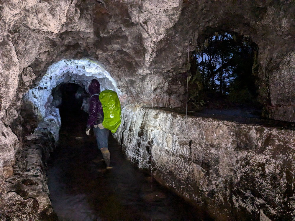
Entering the Kohala Ditch.
The water was ankle deep and flowing slowly in the direction we were walking. The tunnel averaged six feet tall,
which is my height, and as a result I needed to stoop. It averaged about five feet wide. Our walking pace in the
water was significantly slower than on a trail due to the drag on our feet. The tunnel passed straight through the
mountains, unlike the switchbacking trail, so it wasn’t possible to switch between the two until we had covered two
miles.
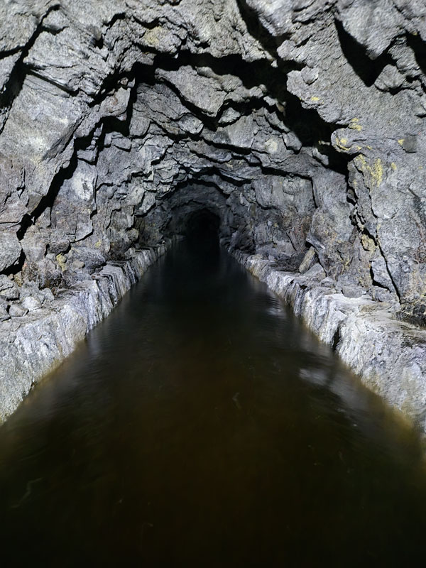
The walls of the tunnel sparkled in the light of our headlamps. We walked along without talking due to the loud
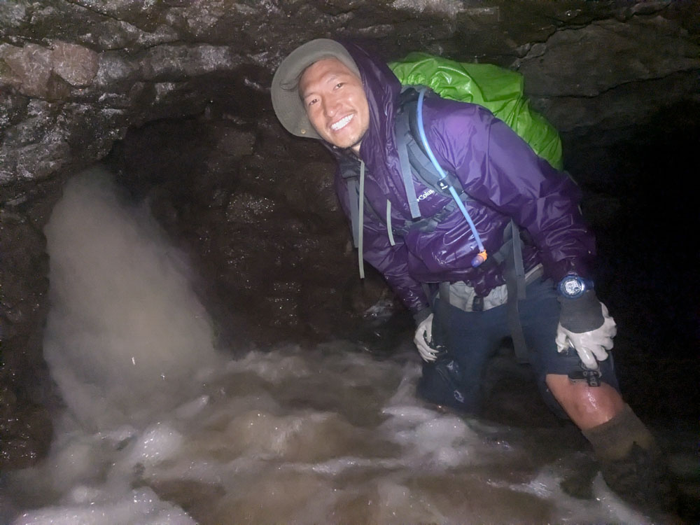
sloshing of our feet. After a while, we could hear rushing ahead. This was the intake of Kaʻilikaula, which had been
the treacherous river crossing earlier. As we approached, the floor rose due to a buildup of gravel that had been
carried in from the intake. I had to stoop more in order to not hit my head. There was dense plant matter here too,
making each step feel like mud. The plant matter was noticeably warm against my legs. Decomposition is
exothermic, I thought. Fantastic. But we passed by the intake without incident, and the buildup of gravel
rapidly decreased. We could stand again, so I took a photo of Chris by the intake.
One of the two stream crossings was complete! We continued walking. The depth of the water slowly but steadily
increased. Over the next 45 minutes, the water went from knee-deep to thigh deep and then waist deep. Chris and I
tightened our shoulder and waist straps until they were as tight as possible in order to raise our backpacks. Each
of us held the bottom of his pack and pushed it upward in an increasingly futile effort to keep it above the water’s
surface. Soon this became impossible, and the bottoms of our backpacks were consistently submerged. Our gear is
getting soaked, but it will be alright because we’re getting out tonight, I told myself.
I realized my phone was in my pants pocket and had been submerged for an extended period of time. I pulled it out.
It was still operating. Evidently my Google Pixel 6A was waterproof. I asked Chris to tuck it into the top compartment
of my backpack.
We passed by a vent hole. This was the first access to the outside world we had seen in quite a while. We continued
onward. The water was chest-deep at this point. "Chris, how much farther is it? I’m concerned about the water depth.
Are we going to end up neck deep?"
"I’m not sure," he replied. "We can go back to that vent and get a GPS lock to check our progress."
I liked that idea, so we turned around and walked 200 feet upstream. The gap between the ditch’s retaining wall and
the ceiling was only about 18 inches high. It was an extremely tight fit to jam ourselves through this while wearing
the backpacks. Major exertion was necessary to scrape the backpacks along the ceiling through the gap. We walked through
the short tunnel to the surface and then stood at the edge of a precipice. There was blackness ahead of us. It seemed
this vent was in a cliff. We couldn’t go up or down.
But it was adequate to get a GPS lock on our phones. We had covered 1.25 miles in the last hour. It felt a lot farther
than that, but our pace had been slow due to slogging through the increasingly deep water. We had half a mile to go. That
would probably take another half hour or 45 minutes due to our slower pace in the chest-deep water.
My entire body was shaking from the cold at this point. I hadn’t noticed how cold I was before. The chest-deep
water had dropped my body temperature, and the air chilled me further now that I wasn’t exerting myself. "You look
dangerously cold," Chris said.
We reflected on our options. "The water shows no sign of getting shallower. I think it will continue getting deeper
until it’s neck deep. I don’t want to walk another 40 minutes and then turn around due to the depth or a raging inflow
at Honokeʻa. I’m too cold. I think we need to turn back," I said.
Chris seemed concerned about me. "Yeah, I think we should turn back."
I ate an energy gel to increase my blood sugar and metabolism. I needed the energy and heat. Crawling back over the
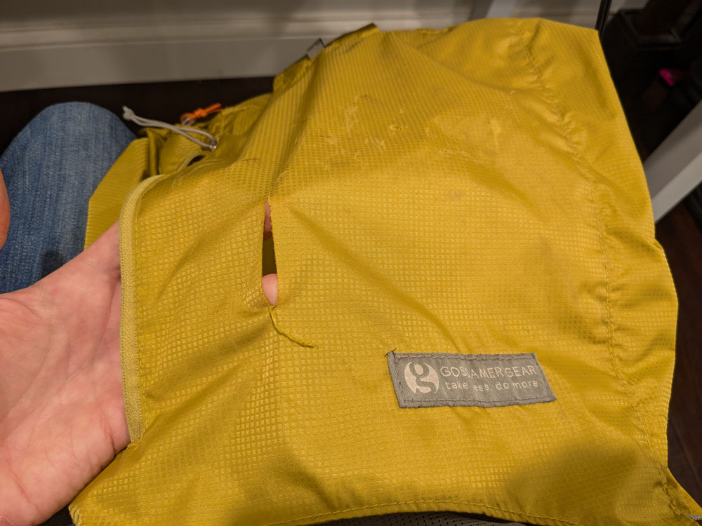
retaining wall into the gap was harder the second time. The top of my backpack ripped as it dragged across the rock. I
shuddered deeply as I dropped back into the chest-deep cold water. Now we would have to to walk against the current for
at least an hour.
As we made progress upstream and the water level dropped, I steadily felt warmer. By the time we reached the
Kaʻilikaula intake, I no longer felt hypothermic. But I was tired, and I whacked my head on the rock ceiling several
times, which produced painful, swollen lumps on my head that lasted a few days. After another half hour, we
reached the point we had entered the ditch at Honopue Valley. We clambered out; we had been inside the tunnel for 2.5
hours. I sent a text via InReach saying our tunnel route had failed, and we would head back to Kaukini Cabin for the
night.
25 minutes later, we arrived back at the cabin. It was 9 PM. We had been hiking for 12 hours. We hurried to set up
camp. We changed from our sopping clothes into our merely damp clothes and ate the last of our freeze-dried dinners.
We had carried food for five nights, and this was our fifth night. We had failed to hike out that day and ultimately
returned to the same location as the previous night, but we were happy to be alive and out of the rain.
I had purchased a backpack liner bag from Gossamer Gear before this trip. It was basically a thick, clear plastic
trash bag that lined the inside of my backpack to provide waterproofing. This trip was the first time I had used this
instead of a traditional external backpack cover, and the liner provided several advantages. It didn’t need to be put
on and taken off, like the cover. It couldn’t rip off in bushes and get lost, as Chris’s cover had. And it gave some
protection against submerging the backpack. I assumed that after five days of rough usage, my liner would have pinhole
leaks and my sleeping bag would be soaked. Since I had fallen in a raging river and then later submerged my backpack in
water for over an hour that day, I was astounded when I pulled my sleeping bag from the bottom of the backpack
and it was mostly dry. Somehow the liner had no pinhole leaks at all. Gossamer Gear is good stuff.
Day 6: Let's try that again!
Unlike the continuous rainstorm of the previous night, there were only intermittent rain showers that night. We slept in and
departed our camp at Kaukini Cabin in the late morning. There were no longer waterfalls from the wall of Honopue Valley
onto the trail. Our hike out was uneventful. When we reached Kaʻilikaula stream, the water level had dropped more since
the previous afternoon. Crossing it was easy, and the logs we had laid across it looked strange and out-of-place. It was
hard to imagine that they had been submerged a day earlier. We continued on.
Crossing Kaʻilikaula stream. Our log handrails from the previous day are visible on the left.
The water level and speed had massively dropped at Honokeʻa stream, which had turned us around the day before. Chris
was ahead of me and had already crossed by the time I caught up to him. The water was thigh deep, but no longer rushing,
so it was easy enough to cross. Once past this, we knew we could make it out to Pololū.
Chris had already crossed Honokeʻa stream when I arrived. This photo is the same angle as this one
from the previous day.
The rest of the hike out was largely uneventful. A family of pigs repeatedly ran around us as we started the descent
into Honokāne Iki. While watching them cautiously, I placed a foot badly and took a significant fall. My ankle exploded
in pain and I was briefly worried I had sprained it. To my immense relief, the pain rapidly decreased and I was able to
walk normally. 10 minutes later, I discovered that my water bottle was missing. I dropped my backpack and left Chris,
who surely was displeased, for 20 minutes while I hiked back up the hill and found the bottle. It had launched off my
pack when I fell.
We separated by a hundred yards or so while descending into Honokāne Iki, and another family of pigs ended up
literally between us on the trail. The steep terrain kept them on the trail. Fortunately, they managed to find an escape
and didn’t charge one of us.
The river in Honokāne Nui was overflowing its banks. The water was flowing through the bamboo forest on both sides.
It was just over knee deep and still moving with decent velocity; it probably would have been treacherous a day earlier.
If we hadn’t turned back at Honokeʻa, we might have had trouble here.
When we arrived back to the paved road at the rim of Pololu, my GPS registered 11 miles, 4340 feet of gain, and
5900 feet of loss. Jacob very graciously drove from Kona and picked us up, and we made it back well before sunset.
Chris and I went to a burger restaurant for dinner and, excited to not be eating protein bars and freeze-dried meals,
absolutely devoured our food.
Arriving back at Pololu.